



A property permit lookup isn't a Google search with a definitive “no results” answer. It's a data-integration workflow that must reconcile parcel identifiers, jurisdictions, permit portals, archival records, and timestamps before a lender, insurer, or proptech platform can treat the result as reliable.
The practical method is to start with the parcel, identify every governing agency, query official sources using normalized identifiers, and preserve the complete event history. Public systems contain valuable records, but coverage can be delayed, pre-digital files may be absent, and permits for septic, wells, driveways, or floodplain work may live outside the building department.
Core takeaways:
- Start with the parcel ID, not only the street address.
- Map every relevant jurisdiction and agency before searching.
- Treat an empty result as an unresolved query, not proof that no permit exists.
- Separate granular local records from market-level Census data.
- Cross-reference permits with assessor, GIS, archival, and inspection records.
- Automate recurring verification when the workflow serves many properties.
The difference between a quick lookup and a defensible property record is the quality of the integration behind it.
Why Property Permit Lookup Is Harder Than It Sounds
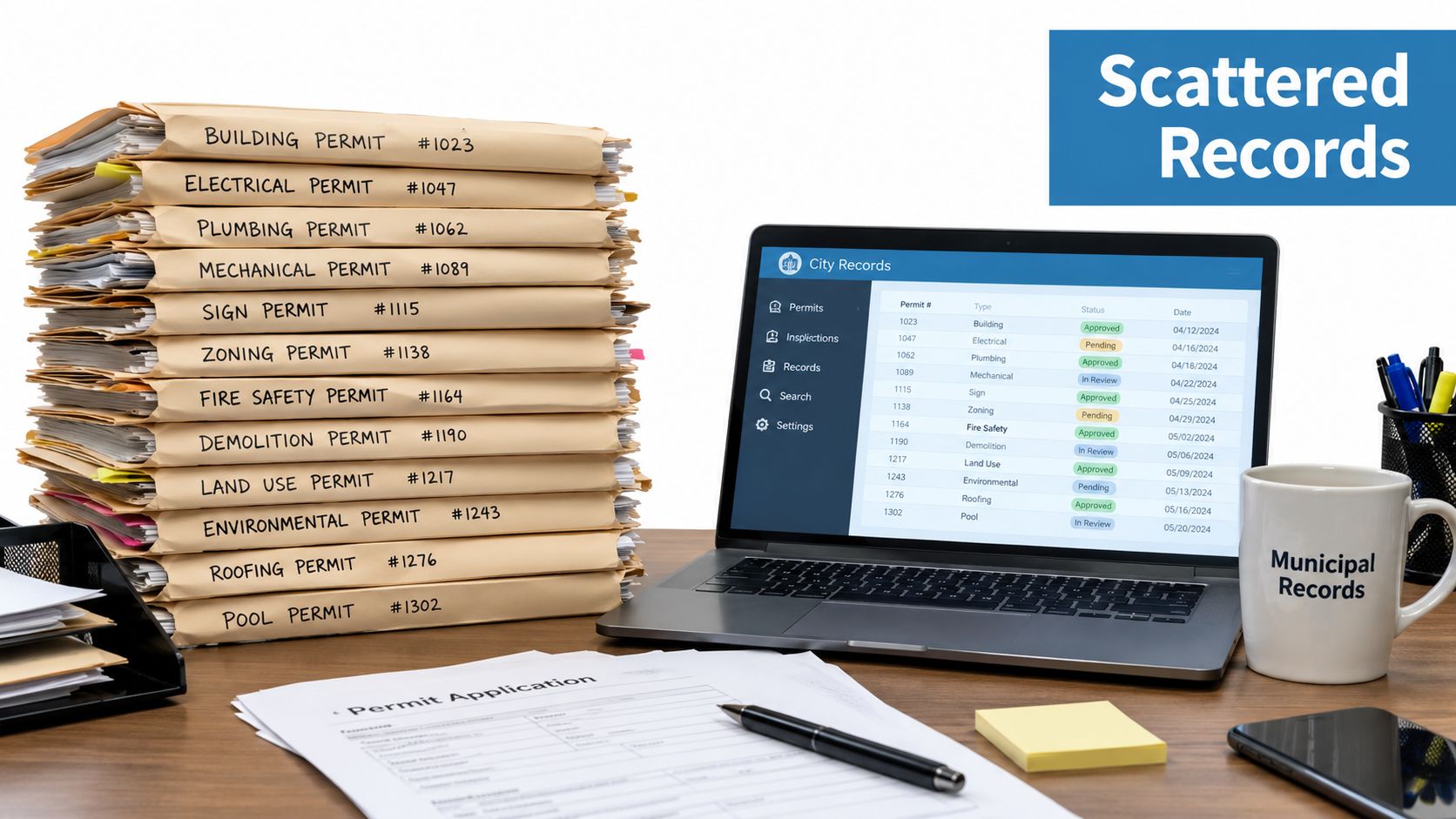
The common advice, “search the city permit portal,” fails because a property rarely has one complete, consistently formatted record. Municipal systems divide information by agency, permit type, identifier, and publication period, so a blank result may indicate a poor query rather than an unpermitted project.
Seattle illustrates the problem. Its current permit and property records portal provides permit activity from 2005 to the present, while archival material includes permits dating from about 1894 to 1970, with microfiche permits from 1970 to 2004 scanned and accessible through its research resources (Seattle Department of Construction and Inspections). Those records form a long historical chain, but the chain crosses different formats and retrieval methods.
The search target is not always the address
Address-only matching breaks when a municipality stores a record under a parcel number, an older address format, a project identifier, or an applicant name. A property can also sit outside the city boundary and fall under a township or county authority. In that case, the city portal is the wrong source even when the postal address contains the city name.
The building permit search methodology reflects the more reliable sequence: resolve the parcel, determine the governing jurisdiction, then query official systems with normalized address variants and the parcel ID. That approach preserves the distinction between “not found” and “not present.”
Practical rule: An empty portal response is a data-quality signal. It should trigger another identifier or source check, not an immediate compliance conclusion.
Historical depth creates a second problem
A current portal may show recent activity while omitting older work because the jurisdiction digitized records only after a particular cutoff. Even when archived documents exist, they may be stored as scanned images without searchable fields. A dependable system therefore needs a historical retrieval path, not just an API request against the newest database.
For proptech and lending teams, this changes the product requirement. The system must expose coverage status, source dates, archive availability, and unresolved gaps alongside permit results. A clean-looking row without those qualifiers can create more risk than a visibly incomplete record.
The Foundational Workflow for Any Permit Search
A defensible property permit lookup begins with the parcel and proceeds through identity, jurisdiction, retrieval, and validation.
Start with the property identity
First resolve the property through the relevant county assessor or GIS record. Capture the parcel ID, assessor parcel number where available, situs address, legal description, and any alternate address representation. The parcel is the stable anchor because street addresses can change, be abbreviated differently, or refer to multiple structures.
Next confirm the governing jurisdiction. A parcel may fall under a city building department, a county authority, a township, or an unincorporated service area. Record that mapping as part of the lookup output rather than treating it as temporary research context.
The construction permit guide for builders can provide useful project-level context on the types of approvals builders may need, but it shouldn't replace jurisdiction-specific records or official determinations.
Query with more than one identifier
Use the normalized address and parcel ID together. Add alternate street formats, directional prefixes, unit information, and older address forms when the portal supports them. Search permit number, application number, applicant, contractor, and project keywords if those fields are available.
Miami demonstrates why identifier flexibility matters. Its permit search accepts a process number, project address, or full folio number, while its iBuild Portal supports process or permit number searches and provides inspection history through the permit number (City of Miami permit history and search guidance).
Preserve the event history
Don't store only the latest permit row. Retain permit number, type, description, received date, issue date, status changes, inspection events, applicant, contractor, and source URL or document reference. A permit marked issued without subsequent inspection information is a discrepancy to investigate, not a completed narrative.
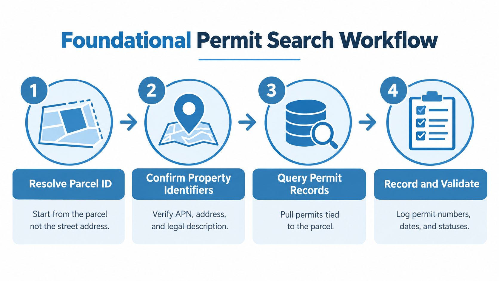
A useful internal record should also show which identifiers were searched, which agencies were checked, and whether archival retrieval was attempted. That audit trail lets another analyst reproduce the result and lets an engineering team measure coverage failures instead of hiding them.
Where to Find Building Permit Records
No single source provides every property-level permit record. Each source answers a different question, so a complete lookup combines local records with property identity data and broader market information.
| Source | Best For | Limitations |
|---|---|---|
| Local building department portal | Permit numbers, descriptions, statuses, inspections, applicants, and project-level details | Siloed by jurisdiction and department, with inconsistent search fields and historical coverage |
| County GIS and assessor records | Parcel identity, legal description, situs address, and property context | Usually doesn't provide the complete permit event history |
| State-level databases | State licensing or agency-level verification where available | Coverage and fields vary by state and may not replace local permit files |
| U.S. Census Building Permits Survey | Standardized new privately owned residential construction data for national, state, CBSA, county, and place analysis | Not a unit-specific property history and not a substitute for local permit records |
San Francisco's Department of Building Inspection provides a strong example of a granular local portal. Users can research building, electrical, plumbing, and boiler permits by site address, permit application or number, applicant information, map, or keywords such as “solar.” Its online permit records extend back to the 1980s (San Francisco permit tracking system).
Berkeley uses a different combination of current and archival access. Building and planning permits issued since 1993 are available in Building Eye, searchable by address, neighborhood, or ZIP, with filters for permit number, date received, and permit type. Earlier permits remain on microfiche and can be requested in digital or printed form (Berkeley permit record research).
Local detail and national context serve different users
The U.S. Census Bureau's Building Permits Survey publishes monthly, year-to-date, and annual data at national, state, CBSA, county, and place levels. Its historical dataset reaches back to 1980 for many areas, making it useful for market analysis, supply monitoring, and geographic comparisons (Census Building Permits Survey).
That dataset tracks new privately owned residential construction. It doesn't tell an underwriter whether a particular kitchen remodel, electrical upgrade, or addition was permitted. A data product that blends Census values into a property-level compliance score without preserving that distinction is mixing incompatible levels of granularity.
For a practical city-specific workflow, the Denver permit search guide is a useful reference point because local procedures, identifiers, and portal behavior differ materially from one jurisdiction to another.
Leveraging Third-Party Providers and APIs
Manual searches become unmanageable when a platform evaluates properties across many jurisdictions. An API or bulk provider can normalize source records, but the implementation still needs source provenance, update timing, and explicit handling for missing jurisdictions.
A provider such as BatchData offers permit records through property-data workflows, including permit descriptions, numbers, types, locations, dates, architects, applicants, and contractor information. For an engineering team, the relevant question isn't whether the output looks uniform. It's whether the normalized record retains enough metadata to explain where it came from and what the source did not cover.

Design the pipeline around evidence
A practical ingestion model should separate raw source data from normalized entities:
- Resolve the property. Match the parcel, address variants, and jurisdiction.
- Fetch permit records. Retrieve all available permits, not just the newest status.
- Normalize fields. Map local permit types and statuses into a controlled vocabulary while retaining the original values.
- Store provenance. Keep source agency, retrieval timestamp, source identifier, and document references.
- Detect changes. Compare new responses with prior snapshots and emit events for new permits, changed statuses, or newly available inspections.
- Expose uncertainty. Return coverage and freshness indicators with the permit data.
Bulk delivery through S3, Snowflake, or flat files can suit portfolio ingestion, while low-latency API calls fit interactive property portals and underwriting screens. The architectural choice depends on whether the workflow prioritizes batch completeness, user response time, or both.
Gate-related workflows have different requirements from permit data, but a gate access API is an example of why teams should evaluate integration documentation, authentication behavior, event handling, and operational boundaries before connecting any external service.
The video below provides another view of the data workflow and can help product teams discuss how property records fit into a broader research interface.
Don't turn normalized data into false certainty. A provider can reduce browsing and matching work, but the application should still distinguish confirmed record, probable match, source unavailable, and historical coverage gap.
Cross-Referencing and Validating Permit Data
A permit record becomes useful for underwriting only after the team tests its identity, chronology, and physical relevance against independent property information.
The first validation pass compares the permit's address and parcel reference with the county assessor record and GIS parcel map. Confirm that the structure or improvement described by the permit belongs to the legal parcel being evaluated. A nearby address, shared lot, or multi-unit building can produce a plausible-looking match that is still wrong.
Validate chronology and agency scope
The second pass reconstructs the timeline. Compare application, issue, inspection, completion, and closure information where available. If a record says “issued” but inspection events are absent, don't silently convert that status into proof of completed work. Flag it for document retrieval or agency confirmation.
The third pass checks adjacent agencies. Building departments may not contain septic, well, driveway, floodplain, grading, or zoning approvals. A property can therefore have a building record that appears complete while related work remains outside the portal searched.
For older properties, request archival material when the online record begins after the likely construction or remodel period. Seattle's separation between current records, scanned microfiche, and older archives shows why a modern portal's earliest searchable date isn't necessarily the property's earliest documented activity.
A reliable result is not a permit row. It is a permit row plus identity, chronology, source scope, and an explanation of unresolved gaps.
State-level records can add another verification layer when contractor or professional licensing matters. Match names carefully because businesses may trade under different names, licenses can involve multiple classifications, and a permit applicant isn't automatically the same entity as the executing contractor.
For change monitoring, a documented change detection workflow can help teams compare successive property snapshots instead of repeating a full manual review. The important design choice is to preserve the prior state so an analyst can see what changed and when the system observed it.
Common Red Flags in Permit Lookups
Permit data should be treated as a measured observation with boundaries, not as a complete legal verdict. The following patterns deserve an explicit exception or review state.
| Red flag | What it may indicate | Recommended response |
|---|---|---|
| No result from an address-only search | Alternate address, parcel identifier, or wrong jurisdiction | Search by parcel ID and normalized address, then confirm jurisdiction |
| Recent work absent from a public dataset | Publication delay or intentional withholding window | Record the retrieval date and check the issuing agency directly |
| Older property with no historical permits | Digitization cutoff, archive separation, or missing files | Search archival systems, microfiche, or records-request channels |
| Building record lacks septic, well, driveway, or floodplain activity | Related work is held by another agency | Query the relevant environmental, public works, or planning authority |
| New York record appears in only one system | Older BIS record or newer DOB NOW application | Check both systems and preserve the source system in the result |
| Large dataset is difficult to browse | Portal expects structured data access rather than spreadsheet review | Use OData, CSV, or an API-oriented extraction process |
Buffalo states that permits issued in the last two weeks are intentionally omitted from its public dataset (Buffalo public data). That isn't evidence of missing compliance. It is a known freshness rule that should appear in a system's source metadata.
Chicago presents a different operational warning. Its permit dataset is large enough that it can't be fully viewed in Excel and is intended for OData or CSV workflows. A team that relies on browser browsing may inspect only a partial view and mistake interface limits for data limits.
New York City requires system-aware searching. The Department of Buildings says its Building Information System contains property profiles with jobs, filings, occupancy information, complaints, violations, and inspections. It distinguishes BIS records for permits and applications created before DOB NOW from newer applications in the DOB NOW Public Portal, with DOB NOW: BIS Options used for drawings, plans, and documents (NYC building data guidance).
Cambridge's 2026 Permit Finder rollout points toward unified views across departments, but consolidation doesn't eliminate the need to verify source scope and update timing.
Implementing Automated Permit Verification
Automation is necessary when a lender, insurer, investor, or proptech portal must evaluate property changes repeatedly. A manual lookup can answer one question, but it can't reliably monitor a portfolio, preserve historical states, or apply the same jurisdiction logic every time.
Build the workflow as an evidence pipeline:
- Resolve jurisdiction dynamically. Store the agency responsible for each parcel and update the mapping when boundaries or portal ownership change.
- Fetch full histories. Pull all available permit events and retain prior snapshots instead of overwriting the latest row.
- Schedule freshness checks. Run recurring retrievals and label records with the time they were observed and the source's known publication behavior.
- Generate review alerts. Notify analysts about new permits, status changes, missing inspection sequences, address mismatches, and unresolved archive gaps.
- Separate decisions from data. Return raw records and confidence states, while underwriting or compliance rules decide what requires escalation.
- Measure coverage. Track successful matches, unavailable portals, archive-only records, agency exceptions, and records requiring manual confirmation.
The Census methodology shows why source behavior must be modeled rather than assumed. Its Building Permits Survey uses a monthly sample of 9,000 permit-issuing places and an annual census of 11,000 non-sampled places, with large metropolitan permit places selected with certainty (Census Building Permits Survey methodology). That survey design serves national measurement, but it also reinforces a critical engineering point: availability, timing, and completeness depend on how each source collects and publishes data.
A dedicated permit tracking system can support the operational layer, but teams should still define their own acceptance rules. A permit API is not a substitute for jurisdiction mapping, historical retrieval, or human review of ambiguous cases. It is the mechanism that makes those controls repeatable at scale.
BatchData provides property and building permit data for API-driven lookups and bulk workflows, with permit details that can be joined to broader ownership, lien, valuation, and property records. Visit BatchData to evaluate a unified data workflow for automated permit verification, portfolio monitoring, and due diligence.