






































You're reviewing a property with a recent renovation, but the municipal portal returns no obvious match. That doesn't prove the work was unpermitted. It usually means the search stopped at the wrong jurisdiction, address format, permit type, or record system.
A reliable building permit search connects three layers: official permit records, property identifiers, and the operational context around each record. National statistics can show construction momentum, but property decisions require parcel-level verification.
- Macro data: The U.S. Census Bureau provides permit series from 1960 to the present, with geography ranging from national and regional data to state, metro, county, and place releases. (U.S. Census Building Permits Survey)
- Local records: Municipal and county systems commonly support searches by address, parcel number, permit number, or contractor license. (Miami-Dade public records search)
- Production reality: Records arrive late, use inconsistent fields, and may distinguish filed, issued, revised, expired, and completed permits differently.
- Scalable workflow: Match permits to parcels, normalize jurisdiction-specific values, preserve status history, and validate missing data instead of treating an empty result as proof of no work.
The useful question isn't whether permits exist. It's whether the records support a defensible conclusion about a particular property.
Why Building Permit Search Matters for Property-Level Intelligence
A market report can show construction activity rising while a buyer faces an unanswered question: does a particular house have a finaled addition, an open electrical permit, or no record for a visible conversion? National totals cannot resolve that address-level uncertainty. Lenders, insurers, investors, and operators make decisions at the property level, where one parcel can carry risks hidden by county or metro averages.
The U.S. Census Building Permits Survey supplies useful market context through a long-running official time series and structured monthly releases. Preliminary data are published on the 12th workday of each month, revised monthly estimates on the 17th workday, and annual 2025 data were released on May 14, 2026. The survey also identifies permit activity as an early indicator of future construction before projects break ground. (Census permit release schedule and data)
That schedule can help analysts track development momentum. It cannot verify renovation work at an individual parcel.
Macro signals versus parcel evidence
The historical series illustrates why market context needs careful interpretation. Since 1960, it averaged about 1.375 million units per month, reached 2.419 million in December 1972, and fell to 513,000 in March 2009. The seasonally adjusted annual rate was 1.374 million in June 2026, compared with 1.41 million in May 2026, and was about 1.79% below the prior year. (Historical U.S. building permit data)
Those movements support timing and risk analysis, yet they do not establish what happened at 18 Oak Street or another specific address. Property verification requires a record-level match across the local authority, parcel identifier, historical address, permit category, and status trail.
For researchers, the distinction separates real estate market insights from evidence about a particular property. A local example, Newton MA building permits, shows how permit information can be organized around one municipality.
A property-level permit search can support:
- Renovation verification: Compare owner, seller, or borrower statements with permits linked to the parcel.
- Unpermitted-work screening: Investigate differences between visible improvements and recorded construction activity.
- Insurance underwriting: Review documented structural, electrical, roofing, HVAC, and other work.
- Investment analysis: Identify recent improvements or unresolved permits that could affect value, closing, or repair exposure.
- Portfolio monitoring: Track new filings, status changes, and construction activity across owned or financed properties.
The record is evidence, not a complete property history. An empty online result may reflect an archive gap, a changed address, a permit filed under a contractor, or a parcel number absent from the search index. Production workflows must preserve those uncertainties rather than convert a failed lookup into a claim that no work occurred.
Identifying the Correct Jurisdiction for Permit Records
The correct permitting authority is usually the city, county, township, or another local agency responsible for the property, not a federal office. Confirming that authority before searching prevents the most expensive kind of failure, a technically correct query sent to the wrong record holder.
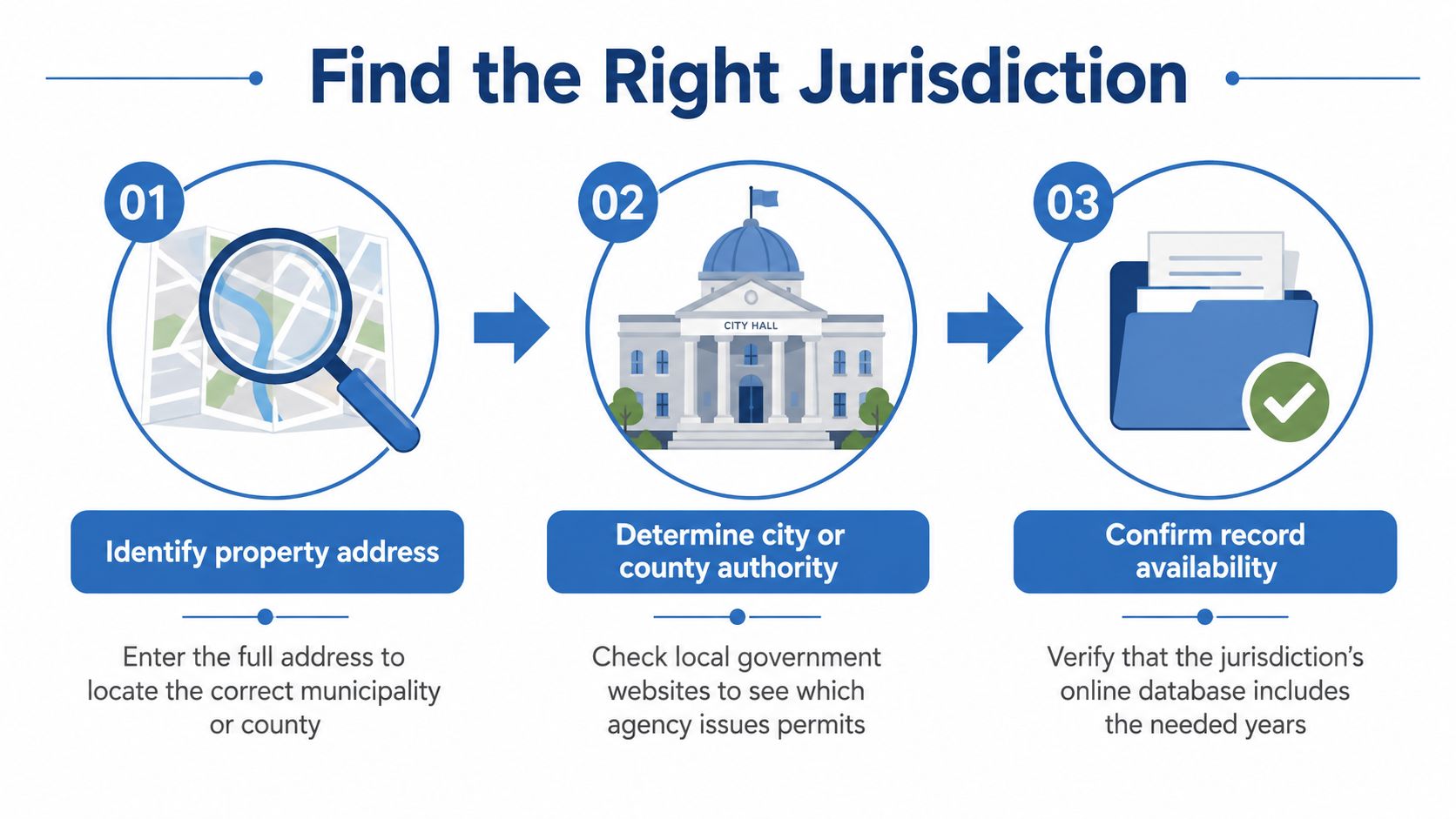
A practical jurisdiction check
Start with the complete address. Include the street number, directional prefix or suffix, unit designation, city, state, and postal code. A shortened mailing address can point you toward a neighboring municipality or an unincorporated area.
Confirm the parcel boundary. Use the county assessor's property record and GIS map to identify the parcel number, municipal boundary, and any signs that the property sits near an incorporated limit. The assessor is a useful starting point, but it isn't necessarily the permit custodian.
Verify the issuing agency. Check the official city or county building department website. Look for permit search, building services, development services, planning and zoning, or an online records portal. Some local governments use shared service arrangements, so the agency name may differ from the municipality shown in the mailing address.
Check unincorporated status. If the property isn't inside an incorporated city, the county often controls building permits. Don't assume the nearest city portal covers it.
Test record coverage. Before concluding that no record exists, determine which years and permit categories the portal includes. Older files may be stored separately, and the online interface may expose only a portion of the department's holdings.
Annexations create a common split. A property may have older county records and newer city records, particularly if jurisdictional authority changed after the original construction. Properties near special districts or shared building services require the same two-source check.
Edge cases that need manual confirmation
A parcel can also span planning or service boundaries, while a project can involve separate building, electrical, plumbing, fire, or zoning authorities. Ask the records office which agency owns each relevant record type.
Practical rule: Treat jurisdiction confirmation as a data validation step, not a preliminary guess. Store the authority name, portal URL, parcel identifier, and coverage notes with the search result.
That metadata becomes important when an analyst later explains why a search returned no match, or when a pipeline must query several agencies for one property.
Searching Municipal Portals and GIS Systems
A property can show no permit match even when permitted work exists. The failure often comes from a strict address field, a separate trade record, or a portal that exposes only part of the municipal archive. Start with the strongest identifier available, then broaden the query in a controlled sequence. Official systems commonly accept project address, parcel number, permit number, and contractor license, as shown in the earlier discussion of municipal records.
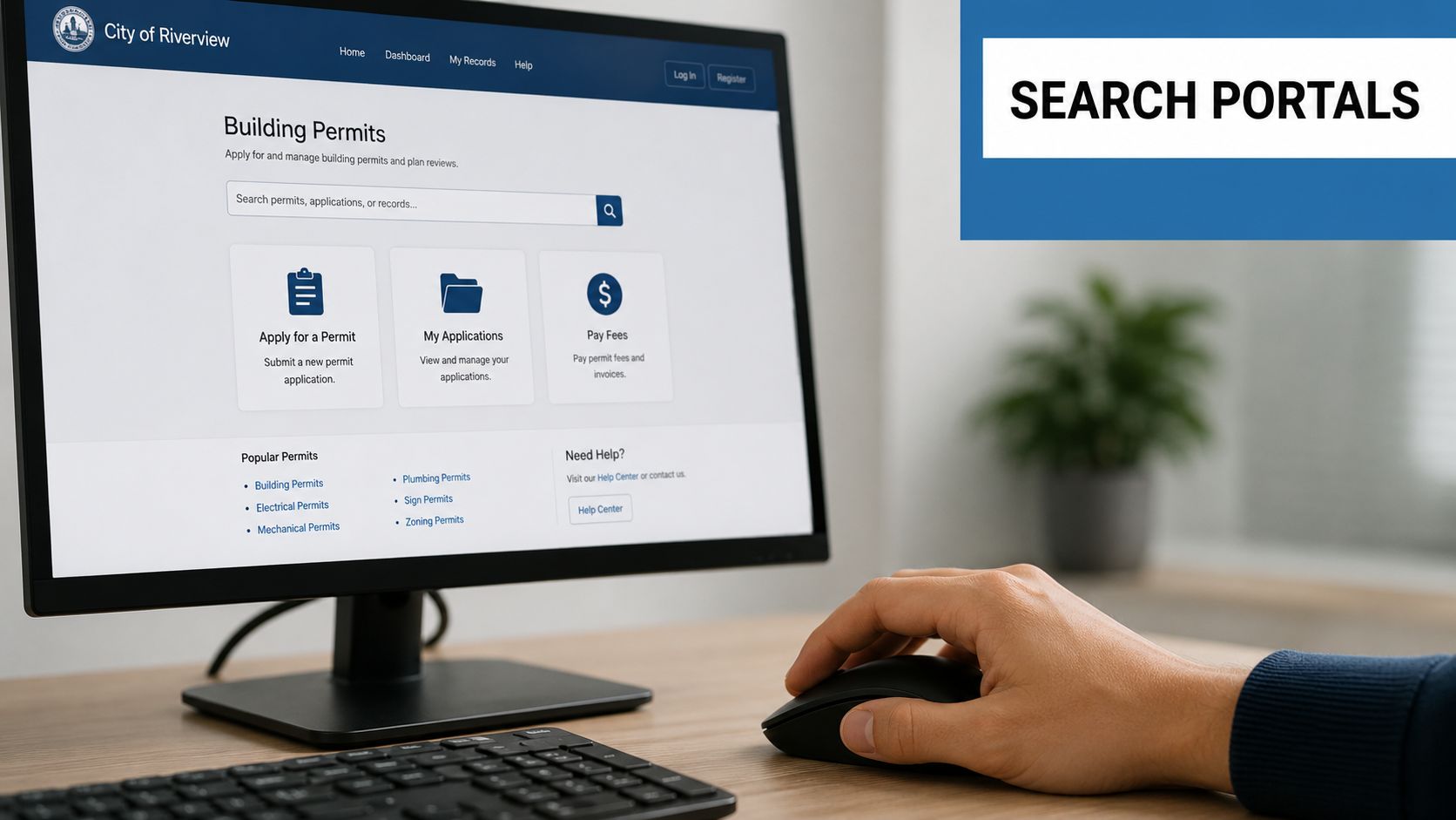
Search in an intentional order
Use the parcel number first when the portal supports it. Parcel identifiers usually remain more consistent than street formatting. Address searches can fail because of abbreviations, unit labels, directional changes, or historical renumbering.
Then test:
- Full address: Follow the portal's exact format, including or excluding unit information as required.
- Street-only search: Remove the unit, directional, or street suffix when the system uses strict matching.
- Permit number: Search it when a seller, contractor, appraisal file, or prior record provides one.
- Contractor license: Use it to find work recorded under an inconsistent property address.
- Owner or applicant: Search these fields only when the portal exposes them and the names are known.
After the identifier search, filter by permit type, trade, date range, and project scale. Permit-search platforms may separate residential, commercial, solar, HVAC, roofing, and other categories, with further trade and scale filters. (Permit Scout search filters)
Read the record, not just the result count
A result row is an index, not verification. Open the detail page and capture the permit number, description, applicant, contractor, issue date, expiration date, inspections, revisions, and final status when available. Status labels differ by jurisdiction, so map local values into an internal vocabulary while preserving the original text.
GIS supplies spatial context. Maps can show permit clusters, nearby active work, and records associated with neighboring addresses. Export options vary. Some portals provide CSV downloads or GIS services; others require manual downloads or a records request.
Portal behavior also affects production pipelines. Registration walls, session timeouts, rate limits, JavaScript-only forms, and temporary outages can interrupt valid searches. Record the query, timestamp, portal behavior, and fallback action. Denver permit search guidance illustrates the local variation analysts may encounter, while the responsible municipal authority remains the controlling source. This audit trail helps connect fragmented portal results to property-level intelligence rather than treating a missing match as proof that no permit exists.
Using FOIA Requests and Public Records Access
Public-records requests are the fallback when an online building permit search lacks older files, missing attachments, or complete historical coverage. In the United States, the federal Freedom of Information Act isn't a universal shortcut for local building records, so the applicable state public-records law and local agency process usually matter more.
A request works when it identifies the property and asks for records the department maintains. It fails when it demands an interpretation, such as asking the clerk to certify that all work was permitted.
What to request
Use a narrow, auditable description:
Please provide all building, electrical, plumbing, mechanical, zoning, certificate of occupancy, inspection, violation, and closure records associated with [full address], [parcel number], including open, expired, withdrawn, revised, and final records. Please include available applications, plans, inspection results, and correspondence.
Add the approximate project period if known, the preferred delivery format, and a request for an estimate of copying or retrieval fees before work begins. If the property changed names or addresses, include those variants.
A records clerk may explain that the online system covers only newer material, while older files remain in paper or microfilm archives. Some cities still require an in-person visit, and a clerk may be able to print a record when provided with the address. (Public access to older permit records)
Choosing between an API and a records request
| Access method | Best use | Main trade-off |
|---|---|---|
| Municipal portal | A single property with recent searchable records | Interfaces and coverage vary |
| API or bulk feed | Repeated searches across many jurisdictions | Requires normalization and monitoring |
| Public-records request | Older, missing, or non-digital files | Slower and often less predictable |
| In-person archive search | Paper or microfilm records | Staff time and travel can be substantial |
State public-records laws typically impose response windows of 5 to 15 business days, according to the public-records guide cited above. (Records request response windows) A response window isn't the same as a completion guarantee. Agencies may need clarification, locate off-site records, calculate fees, or provide partial releases.
For Canadian projects, the access model differs. Statistics Canada's national permit system surveys about 2,400 municipalities, covers all provinces and territories, and represents about 95% of the population, using mandatory monthly reporting from municipal permitting officers. (Statistics Canada building permits methodology) That national system supports analysis, but local property files may still require municipal access. The same source context is useful when evaluating related documentation questions, such as the cost of building permit drawings Ontario.
Integrating Permit Data with Property Records at Scale
A portfolio pipeline fails when a permit is attached to the wrong parcel. The engineering task is identity resolution and change-data capture, connecting each record to the correct property while preserving what the issuing jurisdiction reported.
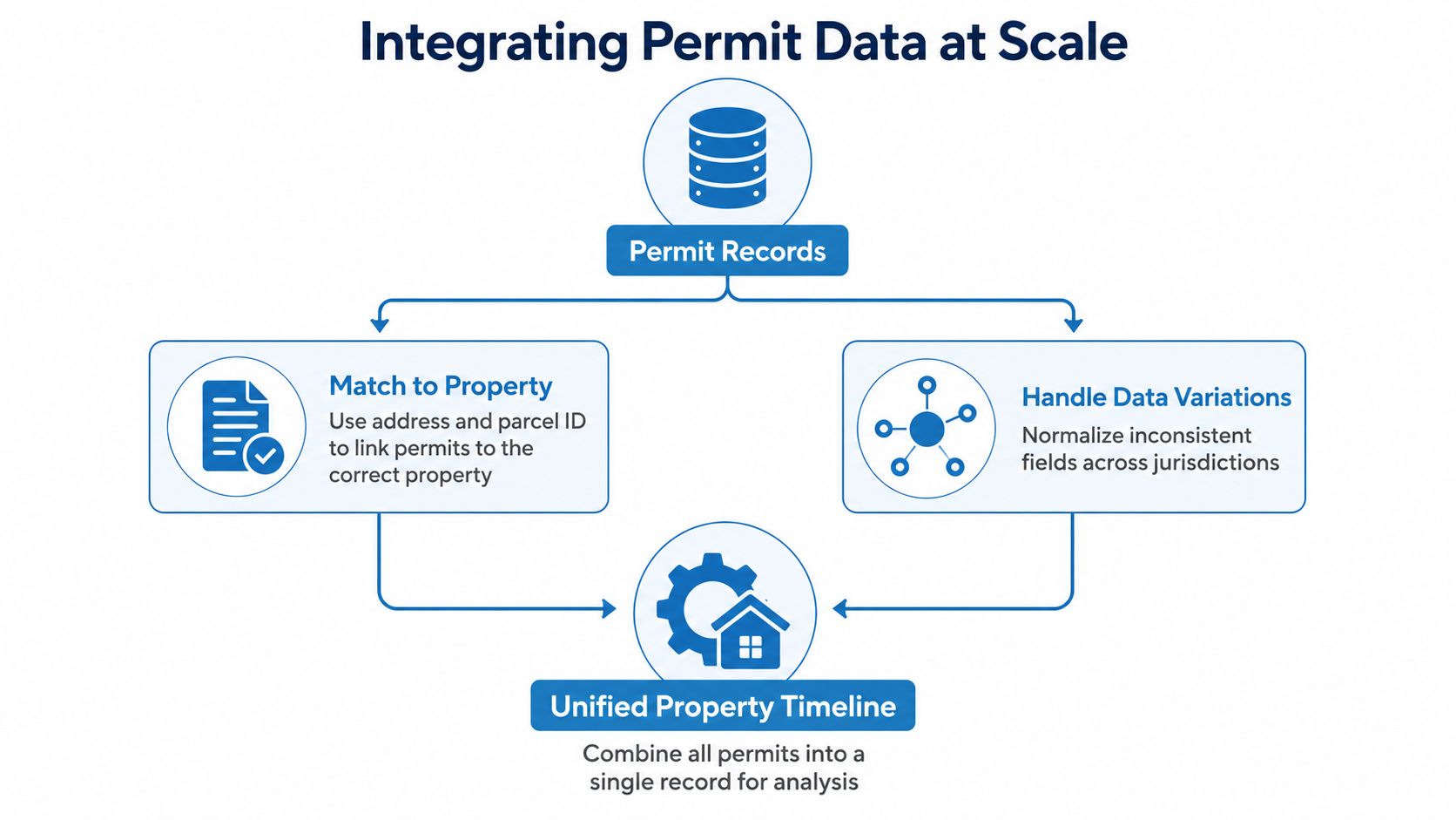
Build the pipeline around stable identifiers
Use several matching signals rather than trusting a cleaned address.
- Parcel-first matching: Match assessor parcel numbers, APNs, or jurisdiction-specific parcel IDs where available.
- Address normalization: Standardize street suffixes, directional terms, unit formats, punctuation, casing, and whitespace, while retaining the raw address.
- Jurisdiction mapping: Assign each record to the issuing agency, not just the city named in the address.
- Secondary evidence: Compare permit number, contractor license, owner or applicant, geospatial location, and project description when the primary match is ambiguous.
- Review queue: Send low-confidence matches to human review instead of attaching them automatically to the nearest property.
Store a canonical permit entity alongside the raw source payload. The canonical record supports analytics. The raw payload preserves jurisdiction-specific fields that may matter later during verification or audit.
For API access, choose endpoints that support incremental retrieval by jurisdiction and update timestamp. Pull new and changed records, perform idempotent upserts keyed by jurisdiction plus permit number, and retain revisions. Overwriting the latest row removes the evidence needed to explain a change from issued to expired or the addition of an inspection.
Model incompleteness explicitly
The U.S. Census methodology shows why missingness needs a defined policy. Its survey combines a monthly sample of about 9,000 permit-issuing places with an annual census of roughly 11,000 additional permit places, and notes that missing new-construction data may be imputed when a report is not received. (Census Building Permits Survey methodology)
That national method cannot verify a specific property file. It does establish an engineering requirement: track source coverage, expected reporting cadence, imputation or missing flags, and late-arriving records instead of presenting every row as equally complete.
The same principle applies across Canadian and European administrative systems. Statistics Canada describes mandatory municipal collection, while the French methodology context describes information becoming nearly exhaustive after 24 months, with nearly 90% known within 3 months, and estimates used to fill missing residential information. (Statistics Canada and Eurostat methodology context) For property intelligence, publish a completeness state and its evidence, not only a record count. Local verification still follows the access process described in Using FOIA Requests and Public Records Access.
A property timeline should distinguish filed, issued, revised, inspected, expired, cancelled, and completed states wherever the source supports them. Use Snowflake data integration practices for storage design, and make the warehouse expose unresolved identity and source-quality problems rather than hiding them.
Common Pitfalls in Building Permit Search Workflows
The most damaging mistake is treating an empty search result as a definitive answer. Municipal systems fragment records by agency, identifier, permit type, and publication period, so “no result” often means “this query didn't reach the record.”
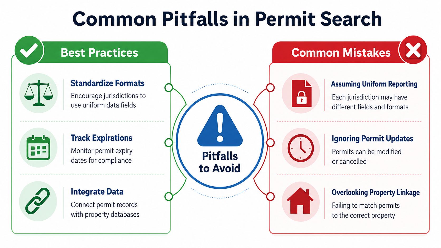
Where workflows fail
| Failure mode | Why it breaks | Production fix |
|---|---|---|
| One portal assumption | The property may fall under county, city, or shared authority | Resolve jurisdiction from parcel and boundary data |
| Address-only matching | Formatting and historical address changes defeat exact search | Use parcel IDs, normalized variants, and manual review |
| Issued equals completed | Approval to begin work doesn't prove final inspection or completion | Preserve status events and inspect closure evidence |
| Latest row only | Revisions and cancellations disappear from the history | Store immutable source events and current state separately |
| One-month analysis | Publication and reporting delays distort recent activity | Track cadence, late arrivals, and completeness status |
Permit classifications also vary. One jurisdiction may separate roofing, mechanical, and electrical work, while another may group them under a broader building record. A normalization layer should map local categories to a shared taxonomy, but analysts should retain the original category for auditability.
Status needs a timeline
A permit can be filed, issued, revised, inspected, expired, cancelled, or completed. These states answer different questions. A lender assessing current collateral risk may care about open work, while an investor studying renovation history may care about issued and final records over a longer period.
Don't infer completion from a permit number, an issue date, or a project description. Check inspection events, final approval, certificate records, or the jurisdiction's explicit closure status. If the source doesn't provide that evidence, report the limitation instead of upgrading an assumption into a fact.
A permit proves a record exists. It doesn't automatically prove the described work was completed, compliant, or reflected in the current property condition.
Complex renovations create another trap. A single project may produce multiple trade permits, revisions, and related planning records. Deduplicating by address can collapse legitimate records, while deduplicating by description can remove meaningful updates. Use permit number, issuing agency, parent-child relationships, dates, and documents to group records without erasing events.
Business Applications for Permit Data Intelligence
Permit intelligence creates business value when teams connect a record to a decision, not when they merely collect permit counts. The strongest workflows combine permit events with parcel characteristics, ownership, valuation, liens, listings, and contact information to determine what action should follow.
Underwriting and insurance review
A lender can compare stated renovation history with permits tied to the collateral property. A mismatch doesn't prove fraud or unsafe work, but it can trigger document collection, appraisal review, inspection, or borrower clarification.
An insurer can use permit type and project description as underwriting context. A recent roof, electrical, plumbing, HVAC, or structural record may help an analyst decide which supporting documents to request. The record should remain one input among inspection findings, property characteristics, claims history, and applicable underwriting rules.
For acquisition due diligence, create a property-level exception queue:
- Open-status records: Request closure evidence or determine whether work remains unresolved.
- Description mismatches: Compare permits with observed additions, conversions, or major improvements.
- Missing historical coverage: Record the jurisdiction, years searched, and archive limitations.
- Multiple related permits: Reconstruct the project from building and trade records rather than selecting one row.
Portfolio monitoring and contractor lead generation
Portfolio teams can monitor new permit events against owned, financed, or managed parcels. A new filing may justify a review of construction progress, insurance coverage, borrower communication, or property valuation. The alert is useful only when it includes the property match, source jurisdiction, permit category, date, status, and confidence level.
Home-service marketers can filter permit activity by relevant trades, then apply geographic, property, ownership, and contact rules. Roofing contractors need different signals from solar installers or HVAC companies. A permit record can identify potential timing and project type, but outreach still needs compliance review and accurate contact enrichment.
BatchData can be one option for this kind of workflow. Its platform provides property records and permit-related data through developer-oriented APIs and bulk delivery options, allowing teams to connect permit attributes with property and ownership records rather than maintaining every municipal integration independently. Visit BatchData to evaluate whether its property and permit data services fit your underwriting, portfolio monitoring, due diligence, or home-service lead workflow.
The practical standard is not maximum volume. It's a traceable chain from permit event, to correct parcel, to business action, with uncertainty visible at every step.