



Every Parcel From One Source. Built for Public Programs.
TRUSTED BY LEADING BRANDS

























Parcel Records Are Spread Across Counties
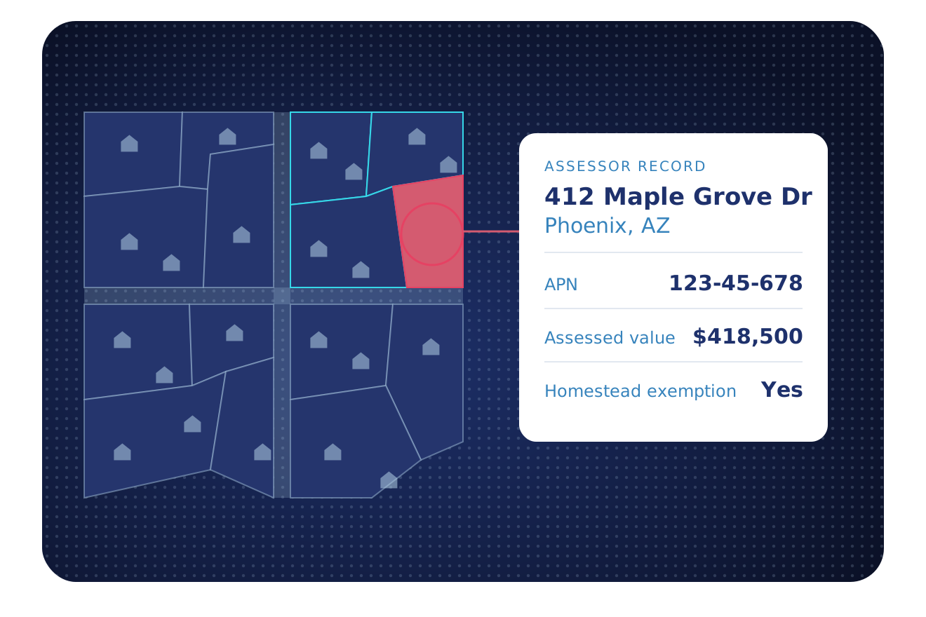
Local offices in 3,100+ counties keep their own permits, deeds and parcels. BatchData joins them into one source for urban planning, tax assessment, and emergency response.
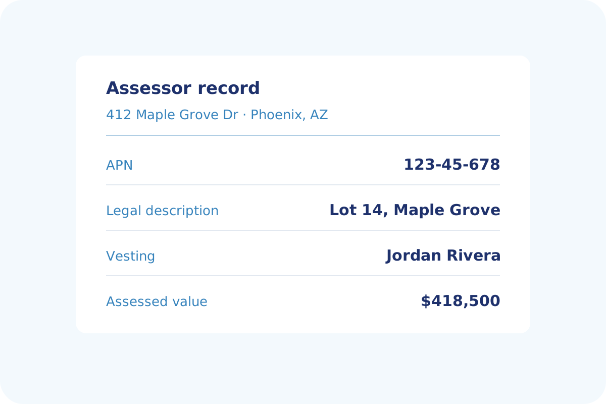
Read Every Assessor Record
See who owns a parcel, what it is assessed at and what tax it carries, all in one source. Each record also lists the APN, legal description, vesting and homestead exemption.
- APN, legal description and vesting
- Homestead exemption and assessed value
- Tax amount and the tax year on record
- Owner name and mailing address
Map Every Address for Response
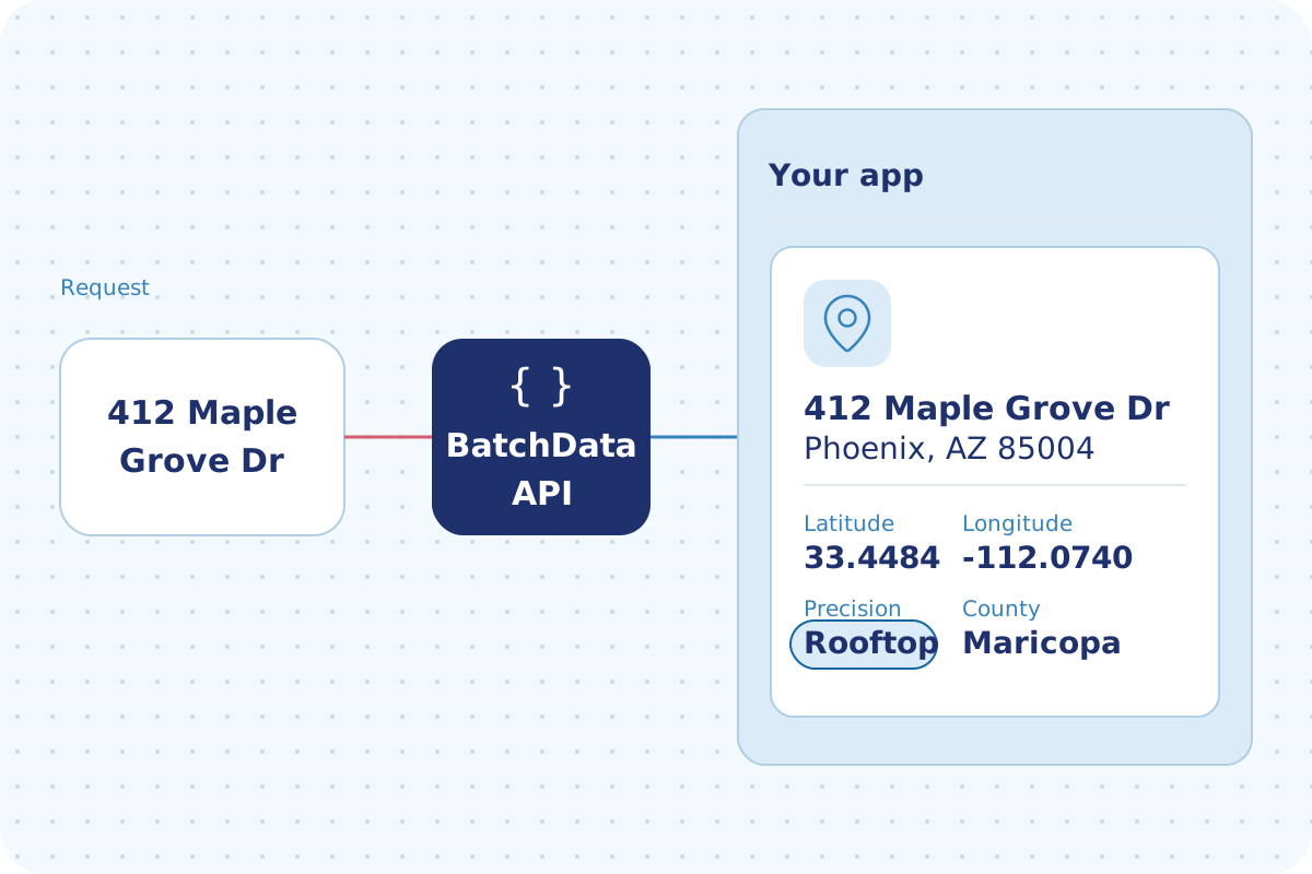
Emergency teams need one location for each address. Send an address and get its latitude and longitude back.
- Latitude and longitude for each address
- One standard address format before matching
- APN and parcel details for each match
- Owner name and property details
The Data Behind Every Parcel
Parcels, buildings, owners and records, tied to the same APN.
Assessor and Tax Details
APN, legal description, vesting, homestead exemption, assessed value and tax amount.
Building Characteristics
Construction type, square footage, and pool or garage details for each parcel.
Market Trends
Sale prices and recent sales that show housing trends by area.
Owner Profile
Owner names, mailing address and the number of properties owned.
Deeds and Sales
Sale price, recording date and document type from deed records.
Liens and Mortgages
Open and involuntary liens, plus mortgage type and interest rate.
Phone Number Verification
Mobile or landline, Do Not Call (DNC) status and calling-lawsuit flags for each phone number.
Match Your List
Match and Append links your address list to parcels in one standard format.
Permit Records
Permit type, number, dates, applicant and contractor for each permit.
Six Ways Public Teams Use BatchData
Planning, assessor, housing and emergency teams each start from a different record.
Watch an Area for New Deeds
Get an alert when a new deed matches the parcels in your search area.
Assessor and Tax Records
Read the APN, legal description, vesting and assessed value for each parcel.
Owners Behind an LLC
Trace LLCs and trusts to the people who own the parcel.
Track Building Permits
Follow new construction and remodel permits, with their dates and job details.
Study Neighborhood Demographics
Household size, composition and income range, linked to property records.
Deeds, Mortgages and Liens
Read deed, mortgage and lien records for housing and planning work.
Coverage Behind Your Parcel Records
National parcel, permit and recording data. We process newly recorded documents daily.
Why Public Teams Choose BatchData
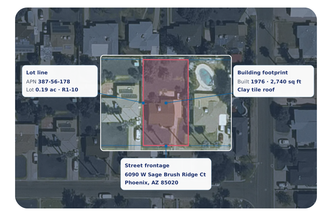
Read the building details and sale history, then add the automated value estimate (AVM) where it covers the property.
Each parcel gets its address, value and owner in one table.
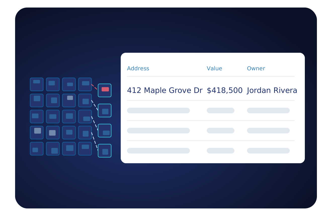
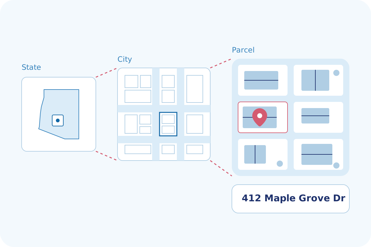
Search by city, county or zip code, then open one parcel and its record.
Flexible Delivery Options
Pick the way your team works. Start with one and add the others when you need them.
- An API your developers can call
- Answers in under a second
- Look up one property or send a list
- Guides and a test tool for your developers
- Address autocomplete with coordinates
- Monthly plans that grow with your usage
- Data files for the markets you choose
- CSV files
- Files sent to a secure folder, Amazon S3 or Google Drive
- Direct delivery to Snowflake, BigQuery or Databricks
- Scheduled refreshes on your timeline
- Watch your list of properties for changes
- Alerts for new listings, liens, defaults and sales
- Alerts sent into your app or CRM
- New matches for a saved search, pushed to you
- A property database refreshed daily
Frequently Asked Questions
Answers to common questions about BatchData for government and public-sector teams.
Ready to Map Your Parcels?
Tell us your program and your area. We show you the details, the coverage and a plan that fits.