Stop trusting the first formatted address a reverse geocoding API returns. That's the most popular advice in tutorials, send latitude and longitude, display result one, move on, and it's also how teams attach the wrong street, owner, or delivery stop to a perfectly good coordinate. A formatted address is a nearest-feature estimate. Whether you can use it depends on match type, distance to the returned feature, and a check against the record that governs your decision.
What Does a Reverse Geocoding API Actually Return?
A coordinate does not prove a street address. It proves a point was measured, and a reverse geocoder then interprets that point against its map index.
Say a field app drops a pin at the edge of a suburban parcel. The pin sits closer to the road centerline in front of the house next door than to the building footprint you care about. The API returns a clean, plausible address, complete with house number. It's also the neighbor's address.
That's normal behavior, not a bug. Google's reverse geocoding documentation defines the job as translating a map location into a human-readable address using latitude and longitude. OpenStreetMap's Nominatim exposes the same model through a reverse endpoint that accepts lat and lon and returns address information for that coordinate.
What Comes Back
A typical response gives you street, neighborhood, city, administrative region, postal code, and country, plus result types and one formatted string for display. The engine picks the most relevant mapped object near the point. Output shifts with map coverage, GPS error, interpolation along a road segment, and the level of detail you request.
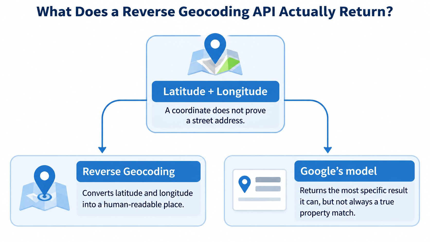
Your pin can land on a parcel, a road segment, a building footprint, or an administrative boundary rather than a numbered door. Each landing produces a different kind of answer, and the formatted string hides that difference. I would never let downstream code guess which one it got.
Production rule: Store the original coordinates, match metadata, every address component, the source dataset, and a timestamp. If you can't replay why an address was assigned, you can't defend it later.
Treat the API as an enrichment and normalization layer. It is not a replacement for authoritative postal, property, or cadastral records.
- Input: Latitude and longitude, plus provider credentials and filters.
- Output: Components, types, geometry, and a display string.
- Failure: The nearest mapped feature isn't your property or stop.
- Next check: Match type and distance, then a property-record lookup for high-stakes use.
The request schema is where you control how much of that uncertainty the provider shows you.
How Do You Read a Reverse Geocoding Response
Send latitude and longitude, or a Place ID where the provider allows it, plus your key, then parse address components and match type instead of trusting the formatted string. Google's JavaScript geocoding guide notes the API accepts latitude and longitude coordinates or a Place ID and returns address components and address types for dropped pins, location pickers, and similar UI work.
Reverse Geocoding Response Fields to Persist
| Field | What it means | Store it |
|---|---|---|
| Formatted address | Single display string for UI | Yes, display only |
| Address components | Typed parts such as route, locality, postal code, country | Yes, for joins |
| Location or match type | Rooftop, interpolated, geometric center, or approximate | Yes, for gating |
| Feature or place id | Stable id of the mapped object when the provider supplies one | Yes |
| Geometry | Returned point and viewport, not the input GPS | Yes, compare to input |
| Status or error | OK, zero results, or over-query | Yes, for retries |
The Request
A minimal HTTPS GET needs three things. You send the coordinate, you authenticate, and you tell the provider how much detail to return.
- Google schema sample:
GET /maps/api/geocode/json?latlng=40.714224,-73.961452&result_type=street_address&key=YOUR_KEY - Nominatim schema sample:
GET /reverse?lat=40.714224&lon=-73.961452&format=jsonv2&addressdetails=1
Label payloads like these as schema samples, not live output. Your parser should read the same trimmed fields either way: status, formatted address, component array, location type, geometry, and feature or place ID.
The Ordered Results Array
Results arrive ordered. The most specific hit usually comes first, and later hits step outward to neighborhood, city, county, or state. That ordering tempts teams to take index zero and stop.
Don't. Read the type on index zero first. A street_address result with a rooftop location type supports different logic than an approximate result for a postal code area, even when both formatted strings look complete.
A Worked Parse
Say a pin lands near a U.S. street corner. The component array returns separate typed objects: street_number, route, locality, administrative_area_level_1, postal_code, and country. Your join logic keys off those types plus the original coordinate.
The formatted string is for humans. It changes with language settings and local formatting conventions, so it's a poor database key. Two providers can format the same corner differently while agreeing on every component.
Ignore display text for joins. Key off component types, the returned geometry, and the input coordinate you stored.
Reversing a Place ID suits UI pickers where a user already selected a known place. It doesn't upgrade a raw GPS point into a verified entrance. The closest readable address is still an interpretation of the point, not proof of where a building's door sits.
One field settles how much weight the result can carry: location type. Rooftop, range interpolated, geometric center, and approximate describe four different promises. Your gating rules should branch on that field before any address reaches a customer, a driver, or an underwriter.
When Is a Reverse Geocoded Address Wrong
A formatted address is a nearest-feature estimate, not proof that the point falls on a particular property. A plausible street name can still identify the wrong frontage, building, or parcel.
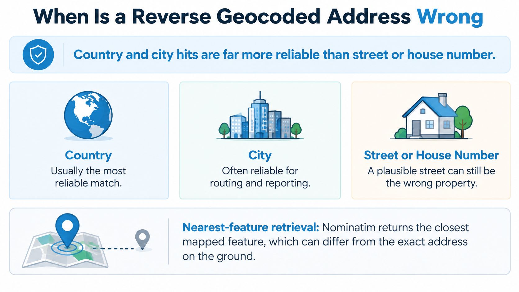
A reverse geocoder retrieves a nearby indexed feature. Nominatim returns the closest suitable OpenStreetMap object, which may be a road, neighbor, or named place rather than the parcel containing the coordinate. Use the match type and distance to judge the result, then check a property record when the decision depends on the exact property.
Expected Reliability by Output Precision
| Precision asked | Reliability guidance | Safe operational use | If confidence is low |
|---|---|---|---|
| Country or admin area | Useful for broad location, but check points near borders | Routing region and compliance jurisdiction | Check points near administrative borders |
| City or postal code | Suitable for broad grouping, not precise property identification | Segmentation and marketing zones | Retry with a broader scope |
| Street | A nearby street may not be the correct frontage | Display and rough routing | Require distance to feature below your threshold |
| Building or house number | Textual accuracy ranged from 0% to 23% across seven free services, depending on precision level and residential density (peer-reviewed evaluation) | Never the sole key for a parcel | Match to an authoritative property record |
Where the Nearest Feature Lies
- Unnamed roads: Small roads may be absent from the index, so a named road farther away wins.
- Dense blocks: A neighboring street may sit closer to the point than the correct frontage.
- Admin borders: A point near a boundary may receive an address from the opposite side.
- Parking lots and campuses: The nearest feature may be a road or amenity inside the site, not the building.
- Large rural parcels: A centroid may sit far from every addressed structure on the land.
- Water and wilderness: With no addressable feature nearby, a returned street can be misleading.
Input quality also matters. A stale or drifted phone location gives the geocoder the wrong point to search around. For field data, adjust iPhone and Android location settings before treating a poor match as an API error.
Benchmark Before You Trust
Build a labeled test set and report recall and address accuracy separately at country, postal code, street, and building levels. Segment results by urban density, rural coverage, border proximity, and coordinate source, such as phone GPS, rooftop point, or parcel centroid. Measure latency, timeout rate, and no-result rate under batch and burst loads.
Set acceptance rules before sending results downstream. Store the raw coordinates, feature type, confidence, and distance to feature with each record. Reject results below your precision threshold, broaden the search once, and send unresolved cases to parcel or authoritative address matching.
How Should You Cache and Throttle Reverse Geocoding Calls
A formatted address is a nearest-feature estimate, not proof that the coordinate belongs to that property. Cache repeat lookups, control request rates centrally, and retain the result type so downstream systems can distinguish a street label from a property match.
Documented Reverse Geocoding Quotas
| Endpoint | Identity | Default ceiling | Bulk stance |
|---|---|---|---|
| Google Geocoding API | API key or OAuth; billing on | Check the current Google Cloud quota page for the applicable limit | Daily quotas are configurable in Cloud |
| Public Nominatim | Valid Referer or User-Agent plus OSM attribution | 1 request per second per application | Bulk and systematic querying are not allowed |
Google's Geocoding API usage and billing documentation says billing must be enabled and requests need an API key or OAuth token. Check the current Google Cloud quota page for Geocoding API limits before setting your throttle; do not assume one default applies to every project or method.
Public Nominatim has a strict maximum of 1 request per second per website or application. Its usage policy forbids bulk geocoding and systematic queries, including grid searches and full postcode or point-of-interest downloads. The public service is not a bulk-processing backend.
The Production Pattern
- Round coordinates to a precision suited to the use case. Five decimal places can support street-level caching; city-level labels can use coarser rounding.
- Key the cache on rounded latitude and longitude, language, and result filter. Store the returned components, match type, and timestamp. See these caching strategies for API-heavy systems.
- Proxy requests through one service so clients share a cache and a rate limiter.
- Throttle below the provider's limit. Leave capacity for bursts and retries, and configure separate limits for interactive traffic and background jobs where needed.
- Retry selectively. Use exponential backoff with jitter for 429 and 5xx responses. A zero-result response usually does not benefit from an immediate retry.
- Monitor request rate, cache hit rate, and no-result rate. A falling hit rate can indicate that coordinate rounding is too precise for the task.
Repeated GPS traces and property centroids should reuse cached results when their rounded coordinates and request parameters match. Store the raw coordinates alongside the cached response so rounding does not erase the original location.
Street and boundary data change more slowly than request volume. A backfill job or a busy driver app can create a sharp increase in calls, so apply the same central rate control to batch and live traffic.
If your workload exceeds public Nominatim's policy, use a self-hosted instance or a paid geocoder with a documented quota. A free public endpoint is not a dependable foundation for recurring high-volume processing.
Where Do Real Estate, Lending, Logistics, and Marketing Teams Use It?
Use the API to turn a point into a place label, then hand high-stakes decisions to a system of record. Each industry gets one output it can use immediately and one decision it must not make from the formatted address alone.
A map pin review is where most real estate teams meet this first.

Real Estate
A dropped pin or a listing photo's EXIF coordinate becomes a candidate street for an agent interface. That's the allowed use: a label a human can confirm. Listing, owner, and tax joins need a property identifier, not the formatted line, because the nearest feature may be the parcel next door.
Lending and Insurance
A rooftop or interpolated hit can prefill city and ZIP on an application and speed up intake. Flood determination, lien checks, and underwriting wait until the point ties to a specific parcel. Route low-confidence rows to manual review instead of letting an interpolated street guess set a premium or approve collateral.
Logistics
Delivery and pickup interfaces, dropped pins, and driver GPS traces need a readable stop label and a locality for dispatch. That's what the geocoder gives you. But on campuses, in malls, and along rural roads, keep the raw coordinate as the navigation target, because the nearest named street can send a driver to the wrong gate. Teams standardizing location display across venues can compare approaches in the Splash Access mapping overview, which covers consistent map presentation across sites.
The operational difference between a label and a target is easier to see than to describe, so walk through a live reverse geocoding flow before you wire one into dispatch.
Marketing
City, ZIP, and neighborhood derived from a consented coordinate can segment campaigns and localize offers. House-number-level activation, attaching phone or email outreach to a specific home, waits for a verified property and contact match. Segmenting by neighborhood on a coarse match is fine. Mailing an owner based on a nearest-feature guess is not.
The pattern holds across all four: the geocoder names the place, the system of record authorizes the action. Teams that blur that line end up explaining to a homeowner, a borrower, or a regulator why a map label drove a financial decision.
What Privacy and Licensing Rules Apply to Reverse Geocoding?
A precise coordinate tied to a person is personal data, so set a stated purpose, minimal retention, and provider terms before the first call. You can't retrofit a lawful basis onto a warehouse full of GPS traces.
GDPR treats identifiable location data as personal data. CPRA classifies precise geolocation as sensitive personal information. Both frameworks push you toward the same discipline: collect for a declared purpose, keep only what that purpose needs, and delete on schedule.
Retention Discipline
Log the purpose for each coordinate stream separately. Driver tracking, property enrichment, and campaign segmentation are different purposes with different retention clocks. Delete raw GPS traces once you've stored the derived fields your use case needs.
Where the use allows, keep the rounded cache key with the returned components instead of the full-precision trace. Rounding that you already do for caching doubles as data minimization. Apply the same hygiene across your stack using data privacy best practices for property data teams, and document consent capture the way Waymap's guide to consent management describes, with the basis recorded before collection starts.
Provider Licensing
Licensing differs sharply by provider. Public Nominatim requires a valid Referer or User-Agent, visible OpenStreetMap attribution, the ability to switch providers on request, and proxying with caching. It forbids systematic grid queries and full postcode or point-of-interest downloads, which rules out building your own address database from the free endpoint.
Google requires billing and an API key or OAuth token, and its terms govern what you may store and redistribute. Check current storage limits before caching results beyond your own application or feeding them into models and exports. Teams get burned here when a warehouse pipeline retains results the license only allowed for display.
A cached address is not consent to contact an owner. Your contact basis comes from the use case and its consent record, never from the geocode itself.
Write these three decisions down before launch: the purpose for each stream, the deletion date for raw coordinates, and the storage rights your provider grants. If legal can't point to that document, you're not ready to ship.
How Do You Evaluate a Reverse Geocoding Provider?
A formatted address is a nearest-feature estimate, not proof that a coordinate identifies a property. Score the returned metadata and the downstream match, not a single accuracy percentage. A vendor's headline number says little about how its API handles your coordinates.
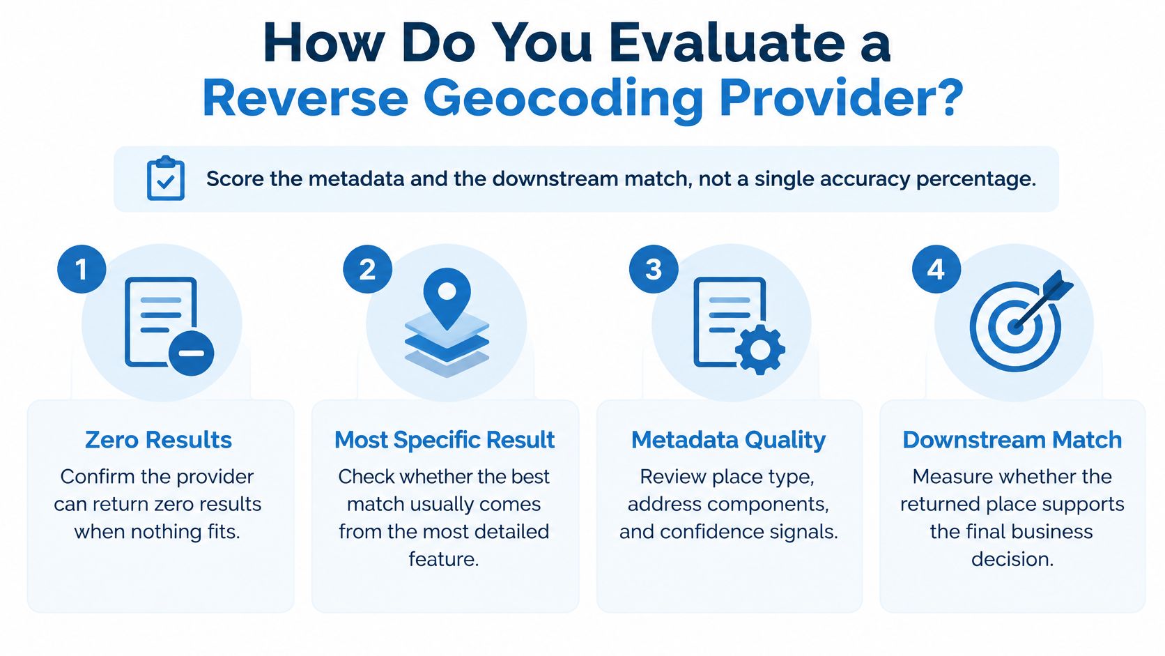
Google's reverse geocoding request guide notes that a request can return zero results and that the first result is generally the most specific. Other results may describe a neighborhood, city, county, or state. Your application needs to inspect the match type rather than assume the first result is a property address.
Provider Evaluation Scorecard
| Criterion | What to require | Failure sign |
|---|---|---|
| Match type | A label such as rooftop, interpolated, geometric center, or approximate for each result | Only a formatted string |
| Distance to feature | Distance from the input point to the returned feature | No distance field |
| Zero results | An explicit zero-results status and a defined retry path | Silent substitution with a nearest-feature guess |
| Stable IDs | A feature or place ID for each result | No stable ID, only text to reparse |
| Quotas and batch | Documented QPS, daily quota, and batch options | No written limits |
| Attribution and storage | Written caching and redistribution rights | Caching is banned or rights are undefined |
Require match type, distance to feature, feature category, and a confidence or partial-match flag. Without these fields, your code cannot distinguish a rooftop result from a locality centroid. Comparing how a rooftop geocoding API labels match precision can help frame the questions you ask providers.
Test on Your Own Ground
Build a labeled sample that reflects your actual inputs: dense urban blocks, rural roads, campuses, parking lots, and border points. A demo city can hide differences between providers. Pay particular attention to the least reliable coordinates in your sample.
Run the Cascade
- Reverse-geocode and persist the coordinates, address components, match type, and distance with each record.
- Use coarse results for coarse decisions. Country, city, or ZIP may work for display and segmentation when the match type is coarse.
- Match to a property record. Lending, insurance, acquisitions, and owner-contact workflows need a parcel or property ID. BatchData is one option for U.S. property data, supplying ownership, valuation, and attribute data for U.S. parcels that you can match against your own identifiers.
- Queue uncertain results for review. Send rooftop mismatches, border hits, and zero results to review instead of writing them into production tables as confirmed addresses.
A map label can use a geocoder response. Decisions involving money, compliance, or homeowner contact need a property match.
Provider accuracy alone does not settle the question. Clear uncertainty metadata and a downstream entity match matter more than a single claimed percentage. Run difficult production coordinates through your finalist providers, then count how many formatted addresses fail a property-record check. That result is more useful than a sales claim.
Coordinates from pins, photos, and GPS traces can produce a plausible address that points to the wrong feature. BatchData supplies U.S. property records with ownership, valuation, and contact data. The next step is to match property records to your addresses and check how many formatted addresses survive a property-record match.