Your address lookup returns a pin, the build goes green, and then a driver, adjuster, or parcel join proves the pin sits on the wrong building. That's the gap a rooftop geocoding API is supposed to close.
It doesn't, automatically. Rooftop is a match class, not a certificate of exactness. Treat it as evidence to score, log, and route according to risk, and you'll get value from it. Store only latitude and longitude, and you'll manufacture false precision at scale.
What a Rooftop Geocoding API Actually Returns
A rooftop geocoding API returns building level coordinates plus metadata that tells you how that point was produced. If you're only saving the coordinates, you're discarding the part that determines whether the result is safe to use.
You've seen the failure. A property near a divided road geocodes successfully, but the point lands across the freeway. A flood check, delivery stop, or parcel join now uses the neighbor's geography while your logs show a clean response.
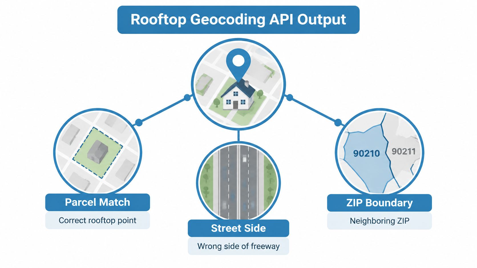
What counts as rooftop
Rooftop geocoding attempts to place the point on the actual structure tied to an address, using an address point or building location reference layer. That differs from address range interpolation, which estimates a position along a street segment from low and high numbers.
That distinction isn't academic. In an Iowa comparison of 5,064 addresses against rooftop coordinates treated as the gold standard, commercial address matching had a median positional error of 90 meters, with an interquartile range of 47 to 215 meters, while E911 locations had a median error of 39 meters and an interquartile range of 22 to 61 meters.
What you must store beside the pin
A rooftop point may be a building centroid or an authoritative situs location. It isn't automatically survey grade, and its quality depends on the reference dataset behind it. Preserve the evidence that lets you audit it later.
- Match type: rooftop, parcel centroid, point, interpolated, or locality fallback
- Confidence score: the provider's match strength, stored unchanged
- Normalized address: what the parser believed the input expressed
- Source and timestamp: which reference vintage created the coordinate
Office directories show the same principle in miniature. When you browse member office map data, the map file is useful because each location carries structured context, not just a dot. Your property pipeline deserves at least that much discipline.
Practical rule: if a response can't explain its own geometry, don't let it drive an automated property decision.
Rooftop vs Parcel Centroid vs Street Interpolation
The right match class depends on the decision your coordinate will trigger. A point that's fine for a regional map can be unusable for a parcel join, and a perfect building centroid can be the wrong target for a vehicle that needs the curb.
Precision classes returned by geocoding APIs
| Match class | What it represents | Typical use case | Risk if misused |
|---|---|---|---|
| Rooftop | Point on or tied to the exact parcel or building footprint | Property intelligence, parcel joins, proximity analysis | Stale or mislocated footprint creates confident false placement |
| Parcel centroid | Center of the land parcel, not necessarily the structure | Ownership, tax, and boundary overlays | Large or irregular parcels put the point far from the building |
| Point on street | Position in front of the parcel along the road | Delivery stops, navigation, field visits | Wrong parcel attribution when used for risk or ownership joins |
| Range interpolation | Estimate along a street segment from address ranges | Broad mapping and aggregate analysis | Building level conclusions drawn from a calculated guess |
| ZIP or locality centroid | Center of a broad area | Coarse display when nothing better exists | Severe aggregation error for property specific decisions |
How to read the class operationally
Use rooftop or parcel centroid results for parcel joins and property intelligence, because the geometry is tied to land or structure. When you're defining boundaries, pair that discipline with sound geolocation practices for property boundaries so a street side point doesn't become a legal geography.
Use a street point when the actor is a driver, inspector, or app user approaching from the road. It answers, where do I stop, not, which parcel owns this risk. Don't promote it into underwriting just because it looks precise on a map.
Keep interpolated and centroid fallbacks out of automated parcel level actions. They're acceptable for visualization and aggregation, with clear labeling. They aren't acceptable as silent substitutes for a building.
One nuance vendors rarely stress. Rooftop describes the source geometry, not absolute positional quality. A current, well maintained interpolated result can occasionally sit closer to the true address than a rooftop point tied to an outdated footprint. That's why class and confidence must travel together, and why your acceptance policy should be use case specific rather than a blanket love of the word rooftop.
How Good Is Rooftop Coverage in Practice
Rooftop coverage is strong in mature datasets, but it is never the whole output. Separate match rate from rooftop rate or you'll misjudge how much fallback handling your system needs.
The visual below frames the evaluation question, not how many pins came back, but how many pins deserved building level trust.
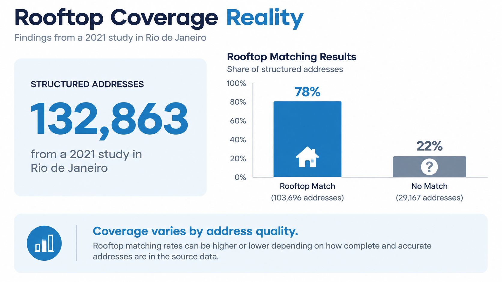
In a study of 132,863 structured addresses in Rio de Janeiro, 85.7% were successfully geocoded and validated, and 83.8% of those validated matches were classified as rooftop level high accuracy. Overall sensitivity was 87%, with a 95% confidence interval of 86 to 88%, and specificity was 98%, with a 95% confidence interval of 96 to 99%.
Those are different dimensions. Match rate asks whether you got a usable location at all. Rooftop classification asks whether that location corresponds to the building rather than a street or locality.
The walkthrough below is worth watching for how address structure affects what's returned, because incomplete or inconsistent fields are where coverage erodes.
What coverage means for your rollout
Plan for a non rooftop tail. Addresses will arrive with local conventions, missing components, and formatting that doesn't match the reference data. Dense urban records behave differently from other land use patterns, so a vendor average won't predict your portfolio.
Require location type and confidence metadata on every response. Without it, downstream code can't distinguish a verified building result from a fallback estimate, and your manual review queue becomes guesswork. Budget that queue before launch, not after exceptions start blocking operations.
Real Request, Response, and Integration Patterns
A sound integration sends a normalized address from your server, stores the full response, and branches on match type before anything downstream touches the coordinate. Don't build the happy path first and bolt on failure handling later.

Single lookup pattern
Send structured components where you have them, street number, street name, unit, city, state, and postal code, plus a stable record identifier from your system. Structured input gives the parser less to infer and makes mismatches easier to diagnose.
Expect JSON containing latitude, longitude, normalized address, match type, confidence, and provider reference identifiers. Persist all of it. If the API returns multiple candidates, store the rejected candidates or at least the selection reason, because ambiguity is itself a useful signal.
- Normalize first: standardize casing, punctuation, and unit designators before the call
- Call server side: keep the API key off the browser and out of mobile bundles
- Validate the class: accept, flag, or quarantine based on match type and confidence
- Write an audit row: input, normalized form, output, timestamp, and decision taken
Batch and failure pattern
For portfolio work, use the provider's batch or asynchronous job pattern rather than firing uncontrolled parallel single calls. Attach an idempotency key to each job or record so a retry can't duplicate charges or overwrite a good result with a later partial one.
Categorize errors before you retry them. Invalid address and no match need data repair or review. Quota and rate limit errors need exponential backoff with jitter. Server errors need bounded retries and a circuit breaker, not an immediate retry storm from every worker you own.
Cache by normalized input plus provider and reference vintage, not by raw address alone. When reference data improves, reprocess deliberately and compare match classes before promoting new coordinates. Silent coordinate drift can change parcel joins, distance calculations, and risk overlays without any code deploy announcing it.
Evaluating Accuracy as a Distribution Not a Percentage
Accuracy is a distribution across geography, land use, and input quality, not a single vendor percentage. If you benchmark only the aggregate, you'll hide the exact segments where your workflow breaks.
Why the average misleads you
Positional error varies by urban density, property type, and address completeness. Low density and high density records don't fail in the same places, and neither do clean structured addresses and messy ones extracted from documents or CRM notes.
Input quality changes the output class in ways vendors can't fix for you. In a correction study of 784 geocoded records, corrected matches landed 81.38% on a building centroid, 5.61% on an exact parcel centroid, 10.08% through address range interpolation, and 0.51% on a ZIP centroid, with 90% of original addresses corrected to a higher accuracy level.
Read that as an operations warning. Missing components, spelling mistakes, and wrong address data determine whether you get a building or a fallback. Rooftop is an observed result to validate, not something a successful status code proves.
How to benchmark like an engineer
Stratify your test set by density, property type, region, and address completeness, then report the share in each match class for every segment. Understanding how confidence scoring should be interpreted matters here, because a score means little until you've tied it to observed error in your own segments.
- Building and parcel classes: eligible for parcel joins and proximity analytics
- Point and interpolated classes: flagged before underwriting, risk scoring, or routing
- Coarse centroids: rejected for property level automation
Set policy from score plus match type plus geography plus use case tolerance. A confidence threshold alone is insufficient, because the same score can carry different positional consequences on a small urban lot and a large rural parcel.
The Privacy Cost of Pinpoint Coordinates
A rooftop coordinate can identify a household, so precision is also a privacy and security exposure. The question isn't only whether you can get the exact building. It's when you should withhold, round, control, or delete that exactness.
Reverse geocoding raises the stakes. It can turn an imprecise device location into a highly identifying building address, even when your product only intended to show a neighborhood.
Displaying a coarsened address doesn't protect anyone if the browser already received the precise coordinate and full response.
That principle is explicit in privacy guidance on showing only an imprecise location, which states that merely displaying a coarsened address does not protect users if the browser has already received the precise coordinates and full API response, so the request must be processed server side with only the reduced result returned to the client.
A precision policy that holds up
- Internal exact use: rooftop coordinates only for authorized workflows with access logging
- Public output: parcel, block, or neighborhood level results on maps and listings surfaces
- Server side calls: credentials stay private, and reduced precision is enforced before delivery
- Lifecycle controls: consent, deletion, retention limits, and regional residency review
Compare your policy against our data handling standards for a concrete example of how a property business discloses collection and use, then align it with broader privacy first data governance in proptech. Don't copy another company's notice. Use it to force your own decisions about purpose and retention.
Direct client side calls create a second problem. Exposed credentials invite quota theft and abuse, and you lose control over what's logged. Keep the rooftop geocoding API behind your backend, return the least precise result each surface needs, and you'll reduce both compliance exposure and surprise usage.
Use Cases Across Proptech Lending Insurance and Logistics
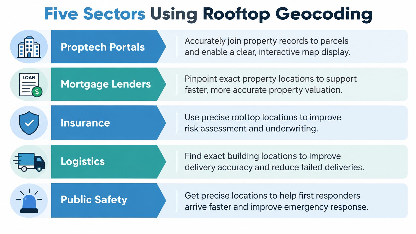
Each sector needs a different minimum match class, and paying for rooftop everywhere isn't automatically the right answer. Match the precision to the consequence of being on the wrong parcel, building, or street side.
Where the threshold should sit
Proptech portals need rooftop or parcel level results for parcel joins, ownership overlays, and credible map display. A street point can guide a visitor, but it shouldn't attach tax, lien, or valuation records to a property. BatchData is one option in this category, offering an Address Geocode API that converts addresses to coordinates and supports reverse geocoding tied to property records.
Mortgage lenders should quarantine interpolated results before flood, lien, valuation, or collateral checks. The coordinate helps locate the asset, but the loan decision needs parcel confidence and an audit trail. Human review belongs on ambiguous, rural, new construction, and multi structure records.
Insurance teams face the sharpest downside from false precision. Property level risk can change across a boundary that a coarse centroid ignores. Accept building or parcel classes for automated scoring, and route lower classes to manual placement or a wider risk geography that doesn't pretend to be exact.
Logistics and field service operators often need the access point more than the roof center. A street side point near the correct entrance can outperform a building centroid inside a large complex. Judge providers on stop usability, not only parcel purity.
Marketing teams can work at lower precision for radius targeting and suppression, provided they don't expose exact residential coordinates. Neighborhood or parcel level output usually serves audience logic without creating unnecessary identifiability.
A Vendor Evaluation Checklist You Can Actually Use
Score vendors on observed match classes in your own stratified sample, not on a brochure accuracy claim. If a provider won't expose match type, confidence, provenance, and refresh practices, remove it from the shortlist.
Questions that expose weak answers
- Match transparency: which rooftop, parcel, point, interpolated, and centroid classes do you return, exactly as named in the API?
- Provenance: which address point, parcel, footprint, and road sources feed each class, and how often are they refreshed?
- Coverage by segment: how do match classes split across my regions, densities, and property types?
- Licensing: can I store, export, join, and reprocess results across internal systems and customer workflows?
- Operations: what are the rate limit, batch, retry, latency, and incident behaviors under sustained load?
- Privacy controls: can I enforce reduced precision, server side processing, retention, and deletion?
- Cost shape: what happens during backfills, reprocessing, failed matches, and seasonal volume spikes?
Don't let a free or familiar baseline distort the test. The U.S. Census Geocoder documentation describing MAF/TIGER address range matching makes clear that it matches against address ranges and calculates an approximate point along that range. Because ranges can include every possible structure number, that point is an interpolation, not proof of a physical structure.
That's useful for census geography. It isn't a rooftop benchmark.
Run the pilot properly
Build a stratified sample across urban density, property type, region, and address completeness. Include your ugliest real records, not a cleaned demo set. Compare providers by match class distribution, disagreement distance, no match rate, and how often manual review changes the class.
Borrow the discipline, not the subject matter, from a checklist for Australian car insurance buyers. Good buyer checklists name exclusions, conditions, and evidence to inspect before purchase. Apply that same skepticism to coverage claims, storage rights, and fallback behavior here.
Adopt one integration policy before rollout. Log the full response, accept only approved classes per workflow, quarantine interpolated results before automated underwriting or risk scoring, and review precision before any coordinate reaches a public surface. Rebenchmark after reference updates, because yesterday's rooftop winner can become today's stale footprint.
Scoring rule: choose the provider whose failures are visible and governable, not the one that hides them behind a cleaner success rate.
Stop accepting coordinates without match class, confidence, and provenance attached. BatchData connects address geocoding and reverse geocoding to property records for mapping, routing, underwriting, and portfolio workflows, so your team can validate the pin against the property behind it. Bring a stratified sample of your hardest addresses and evaluate the results by match class before you commit.