



A parcel in real estate is the fundamental, legally recognized unit of land used by cadastral and tax systems. In the United States, digital parcel infrastructure covers about 150 million parcels, with digital parcels covering 94% of the population and 69% of the land area, according to the National Academies' cited cadastral material.
The popular advice, “just look up the property address,” breaks down quickly. A street address describes where people receive mail, while a parcel record connects land boundaries to ownership interests, taxation, assessment, and legal descriptions. That distinction matters whenever a deed, county map, assessor record, zoning layer, and property database disagree.
The practical takeaways are:
- A parcel is a legal and data unit, not merely a physical lot or a building.
- An APN or similar parcel identifier usually links the property across tax and assessment systems.
- A lot and a parcel aren't interchangeable in every workflow.
- GIS parcel polygons are useful, but they aren't automatically the controlling legal description.
- Reliable PropTech must reconcile conflicting records, especially for splits, mergers, condominiums, and mixed-use properties.
The rest of the answer is operational. It focuses on how parcel identity works in real systems, where the records fail, and how teams can verify the land unit before making a decision.
What Defines a Real Estate Parcel Legally and Technically
A parcel is not just land with a house, warehouse, or vacant field. It is an unambiguously defined unit of land with known boundaries, maintained location data, and legally recognized interests. The National Academies' definition of a parcel treats it as the foundation of property records, rather than a casual synonym for “lot.”
For a product manager, that distinction changes the data model. A parcel is a record object with geometry, identifiers, legal descriptions, ownership interests, assessment attributes, and a history of splits or mergers. Improvements sit on the land but do not define the parcel. One parcel may contain several buildings, a parking area, or no structures at all.
A legal unit and a database key
County assessors, surveyors, title professionals, planners, lenders, and property software all use parcel records, but their records serve different purposes. Assessors support taxation and valuation. Title professionals review legal descriptions and recorded interests. Planners apply zoning and land-use rules to mapped locations.
The same land can therefore appear in several systems:
- Assessor record, with an identification number and valuation attributes.
- Cadastral map, with a maintained geometric footprint.
- Deed, with a legal description and recorded interests.
- Tax map, connecting the land unit to assessment administration.
- Zoning or planning layer, applying development rules to a location.
- Market or property database, adding characteristics, ownership history, or transaction information.
Those records should align, but production data rarely behaves perfectly. A county map may simplify a boundary. An address may cover multiple parcels or units. A deed may describe bearings and distances that do not match the polygon in a public GIS viewer. A recent split, merger, condominium conversion, or unrecorded survey can leave systems temporarily out of sync.
Practical rule: Treat the parcel identifier as a join key, not proof that every connected field is correct.
The FIG's explanation of cadastral systems describes a cadastre as a parcel-based land information system linking rights, restrictions, responsibilities, geometric descriptions, ownership, and value. PropTech platforms need that same layered approach. They should match identifiers across county, deed, assessor, and GIS records, preserve conflicting source values, and flag cases for review instead of forcing one map polygon to stand in for the legal truth. The definition of a parcel therefore combines law and data infrastructure.
How the U.S. Parcel System Scaled to 150 Million Units
The parcel map is not absolute truth. It is a working layer built from surveying practice, property law, tax administration, and local data maintenance. A county polygon, a deed description, and an assessor record can refer to the same property while disagreeing on shape, naming, or status.
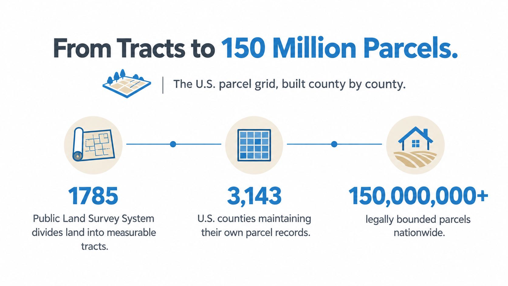
The word parcel comes from the 15th-century Old French parcelle, meaning a small portion of land. In the United States, the Land Ordinance of 1785 established the Public Land Survey System across much of the territory west of the Appalachians, excluding Texas and the original colonies. Its grid-based descriptions still influence how land is divided and referenced across much of the country.
From land division to national infrastructure
Parcelization started as a practical method for describing ownership. Counties later turned it into an administrative system by maintaining assessment maps, local identifiers, and geographic layers. The National Academies' cadastral overview describes the resulting scale:
- About 6,700 or more parcel-mapping jurisdictions.
- Approximately 150 million parcels.
- Digital parcel coverage for 94% of the U.S. population.
- Roughly 2,424 counties with digital parcels.
- Digital parcel coverage across 69% of U.S. land area.
That scale creates a direct data problem. Counties use different identifiers, boundary conventions, update schedules, legal-description formats, and attribute definitions. A national property platform must reconcile those local systems without treating one county's schema or polygon as a universal standard.
The same cadastral material associated the parcel count with a population of 320 million, or roughly 2.1 people per parcel. That ratio does not describe occupancy or household structure. It shows why parcel records and population records operate at different levels, and why address matching alone is unreliable.
Why parcel records carry more than geometry
A parcel record can include an owner, assessed value, sale date, land-use code, and tax account number. A historical discussion of the parcel concept connects the parcel to the long shift from broad tracts toward legally bounded units.
Operationally, the parcel is a link between land and the systems that govern or describe it. A warehouse may store a polygon, but it also needs to connect that geometry with assessment history, ownership, deeds, permits, liens, and valuations. Those connections can break after a split, merger, condominium conversion, boundary adjustment, or delayed county update.
A Snowflake data integration workflow can support the technical side of that work. Integration does not resolve a legal conflict. It can preserve source fields, map local identifiers, retain historical versions, and flag disagreements for review instead of overwriting them.
Decoding Assessor Parcel Numbers and Tax Maps
An Assessor's Parcel Number, commonly called an APN, is a county-assigned identifier used to track a parcel for assessment and tax purposes. It usually provides a more dependable lookup key than a mailing address, but its format and meaning vary by jurisdiction.
The King County property information guidance describes how assessors use parcel identification in property records. Alameda County similarly defines an APN as a unique identification number assigned to every parcel in the county. The number isn't a universal national ID. It is a local administrative key that becomes useful when paired with the county, state, and source system.
How a parcel lookup works
A practical lookup process usually follows this sequence:
- Start with the jurisdiction. Identify the county or local authority maintaining the assessment record.
- Search the APN when available. Avoid relying only on the street address, especially for vacant land, multi-unit properties, or parcels with several addresses.
- Retrieve the assessor record. Check the parcel number, situs address, owner fields, tax account information, assessment details, and update dates.
- Open the tax map or parcel map. Confirm that the geometry corresponds to the record you found.
- Compare the legal description. A map match isn't enough when a transaction, boundary dispute, or development decision depends on the deed.
- Preserve the source and date. A parcel record is time-dependent. Splits, mergers, corrections, and ownership changes can alter the relationship between identifiers and geometry.
New York's tax mapping guide provides a more specific mechanic: each parcel on a tax map receives a parcel number and a coordinate locator number, and parcel numbers on an approved tax map constitute a legal description for the assessment roll. That doesn't mean every map polygon controls every legal question. It means the approved tax map has a defined role in assessment administration.
Why addresses create bad joins
Addresses are designed for locating a destination, not for expressing the complete legal identity of land. One address may correspond to multiple condominiums, a building with several tax units, or a parcel assembled from separate records. A rural parcel may have no conventional street address at all.
For an API or data pipeline, the safer model is to store:
- Original APN, exactly as supplied by the source.
- Normalized APN, for matching across formatting variations.
- Jurisdiction code, because an APN without its county is ambiguous.
- Source geometry, with provenance and update information.
- Legal description, when available.
- Address fields, as supporting evidence rather than the sole identity.
Teams building parcel workflows can use APN-based real estate data practices to structure these joins. The objective isn't to force every record into one neat shape. It's to preserve the local key, create a normalized cross-system key, and expose uncertainty when the sources don't agree.
Parcel vs Lot and the Operational Distinction
A parcel is generally the cadastral or assessment unit, while a lot is more often the subdivision unit shown on a recorded plat and used in development workflows. They can refer to the same land in some contexts, but treating them as universal synonyms creates avoidable errors.
A larger tract may be divided through platting into smaller tracts with unique letter or number designations. The land-survey primer on legal descriptions and plats explains that a plat is prepared by a land surveyor for a specific legal purpose and that a platted subdivision description identifies land by the designation shown on the recorded map or plan.
| Feature | Parcel | Lot |
|---|---|---|
| Primary role | Taxation, assessment, cadastral administration, and property-record linkage | Subdivision, platting, development layout, and recorded lot designation |
| Identifier | Often an APN or local parcel number | Often a lot number or letter on a recorded plat |
| Geometry | Maintained in an assessor or cadastral mapping system | Defined through a subdivision map, plat, or legal description |
| Relationship | May represent a tax or assessment unit containing one or more tax lots | May be one subdivision unit that contributes to a parcel or development record |
| Main risk | Assuming the GIS polygon is the complete legal truth | Assuming the plat designation maps cleanly to the current tax record |
Where the records diverge
The operational problem appears when a product, analyst, or reviewer assumes that every map object has one obvious legal meaning. A parcel polygon may be drawn for assessment administration, while the deed describes the boundary with calls, distances, and exceptions. A lot number may remain familiar in a development context even after tax records are merged or adjusted.
That divergence affects:
- Boundary maps, when a GIS line is treated as a survey-grade boundary.
- Title review, when the legal description includes an exception absent from a simplified map.
- Zoning checks, when the development lot and tax parcel don't have identical footprints.
- Valuation, when improvements or ownership interests are associated with a different assessment unit.
- Portfolio matching, when an address represents multiple land or ownership records.
The Oregon administrative explanation of parcel and lot concepts is useful because it reflects the practical distinction between a tax or assessment unit and a subdivision lot. The right workflow keeps both concepts available.
Don't ask only, “What is the parcel?” Ask, “Which source defines this boundary, for which purpose, and at what date?”
Where Parcel Boundaries Drive Zoning and Conveyancing
A parcel map can be accurate enough for discovery and still be wrong for a closing or development decision. County records, deeds, assessor files, plats, and surveys may describe the same property through different identifiers, shapes, and legal conventions. Treating one polygon as absolute truth creates operational risk.
Cadastral systems generally organize land around parcels and geometric descriptions. Those descriptions may use coordinates, bearings and distances, or polygonal lines, with survey evidence helping re-establish a boundary when a physical marker disappears. The FIG land administration publication provides useful background on this parcel-based structure.
One parcel, several operational questions
Different teams use parcel information for different decisions. A lender may check whether the collateral includes the structure shown in an appraisal. A planner may test whether a proposed building sits inside the applicable zoning lot. An assessor assigns land and improvements to the correct tax unit, while a title reviewer verifies what the deed conveys and identifies easements or restrictions.
- Tax assessment links land and improvements to an assessment unit.
- Zoning analysis applies jurisdiction, geometry, lot configuration, and development rules.
- Conveyancing depends on the deed, legal description, recorded interests, and required instruments.
- Surveying relies on evidence that can re-establish boundaries, not only a screen display.
- Investment underwriting tests whether physical, legal, financial, and ownership records describe the same asset.
A clean GIS polygon can represent an assessor's maintained approximation rather than a survey-grade boundary. That distinction matters when a setback, access point, improvement, or ownership interest sits near the apparent edge.
Where due diligence catches the mismatch
Problems usually surface at the joins between systems. A deed may use one legal description, the assessor may attach a related parcel number, and a zoning database may reference a lot designation. A product that matches only on address or APN can underwrite the wrong area, miss an encumbrance, or apply an incorrect development assumption.
For county-specific research, the Santa Clara County parcel map resource can help identify the relevant mapping workflow. It does not replace the governing deed, recorded plat, or survey when legal boundary precision controls the decision.
Modern property systems reduce this risk by retaining source identifiers, linking historical parcel relationships, comparing geometry, and exposing conflicts instead of making an unannounced selection among competing records. The practical goal is not to force every source into agreement. It is to show which record supports a particular decision and where qualified review is required.
Boundary discipline: Use GIS to discover and compare. Use recorded legal instruments and qualified surveying work to establish what can be conveyed or built.
How PropTech Platforms Normalize Messy Parcel Data
Modern PropTech platforms normalize parcel data by combining source records, preserving local identifiers, matching equivalent properties, and exposing the conflicts that a simple address lookup hides. BatchData offers 155M+ U.S. property records and 1,000+ attributes through low-latency APIs and bulk delivery, according to its platform information.
The engineering challenge is not merely collecting more records. It's deciding which fields describe the same land unit, which values are current, and which differences represent a real legal change rather than a formatting error.
A workable normalization layer
A parcel pipeline typically separates four layers:
- Source capture. Store the original county, assessor, tax, deed, and market fields without destructive cleaning.
- Identity resolution. Match by jurisdiction, APN, coordinates, legal descriptions, addresses, and historical relationships.
- Geometry handling. Retain polygons and metadata while flagging splits, mergers, overlaps, gaps, and stale shapes.
- Business presentation. Expose a usable property record while keeping source provenance and confidence available to downstream users.
This structure handles cases where one address no longer maps cleanly to one land unit. A parcel can split into multiple records, several parcels can merge for assessment or development, and a condominium address can represent many distinct ownership or tax units. Mixed-use properties create similar ambiguity because the building, land, unit, and tax records may operate at different levels.
What normalization should not do
A provider shouldn't choose one source and discard the rest. That approach produces tidy output but weak auditability. It also makes it difficult to explain why a valuation, ownership match, or zoning result changed.
A better system returns:
- Stable internal identity, linked to the relevant local identifiers.
- Original source values, including conflicting attributes.
- Effective or observation dates, where supplied.
- Geometry and coordinate context, not just a formatted address.
- Relationship events, such as split, merge, or condominium association.
- Confidence or match status, so users can distinguish direct matches from inferred ones.
BatchData's stated coverage includes tax, assessment, ownership history, valuations, mortgage and lien details, listings, permits, and pre-foreclosure activity. Those categories can support underwriting, portfolio monitoring, due diligence, and property-level enrichment, but the output still needs source-aware controls when a legal conclusion depends on a deed or survey.
The Shift to Digital Property Identifiers
The next question isn't only “what is a parcel in real estate?” It's “what counts as the parcel when legal records, maps, and software identifiers diverge?” Governments and private platforms are moving toward machine-readable property identifiers because structured keys make cross-system matching more dependable than names and addresses.
A cited example is Japan's March 2026 rollout of an electronic ID system that assigns each residential property and other parcel a unique code derived from the land parcel identification number and other location fields, as described in Nishimura & Asahi's property identifier briefing. The important signal is architectural. A parcel identifier is becoming an interoperability layer between records that were previously difficult to join.
Digital identity creates new edge cases
A machine-readable code can improve matching, but it doesn't eliminate ambiguity. Systems still need to represent:
- Split parcels, where one predecessor becomes several current units.
- Merged parcels, where separate records become one administrative or development unit.
- Condominiums, where the address, building, unit, land interest, and tax record may differ.
- Mixed-use properties, where operational, legal, and assessment views don't align.
- Historical identifiers, which remain present in older deeds and transaction records.
The winning design is not a single universal string with no context. It's a persistent identity graph that keeps the current identifier, predecessor and successor relationships, geometry, source records, and effective dates.
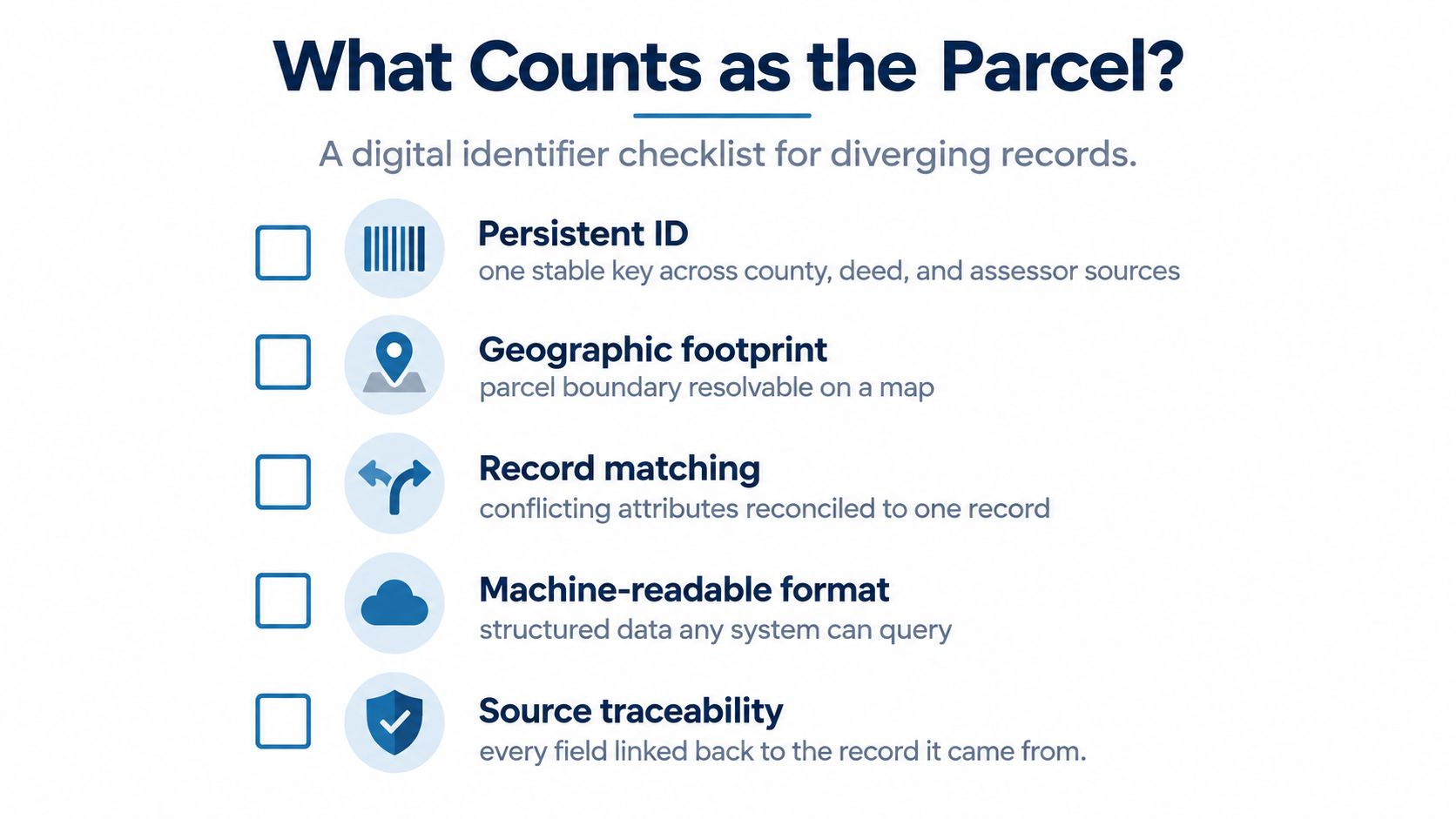
A pre-transaction verification checklist
Before a lender, investor, insurer, broker, or software system treats a parcel as verified, check the following:
- Persistent ID. Can one stable key connect county, deed, and assessor sources?
- Geographic footprint. Can the boundary be resolved on a map and compared with the relevant legal description?
- Record matching. Have conflicting ownership, address, area, and use attributes been reconciled?
- Machine-readable format. Can another system query and process the record without manual transcription?
- Source traceability. Can every material field be linked back to the record it came from?
The operational advantage belongs to teams that can match records programmatically while preserving uncertainty. A parcel map is a valuable input, but trustworthy property infrastructure also records where the data came from, when it was observed, and why two sources were considered equivalent.
BatchData provides parcel-level property records, APN and address lookup, ownership and valuation attributes, liens, listings, permits, and other real estate signals through APIs and bulk delivery. Visit BatchData to evaluate how a source-aware property data layer can support parcel matching, underwriting, portfolio monitoring, and due diligence.