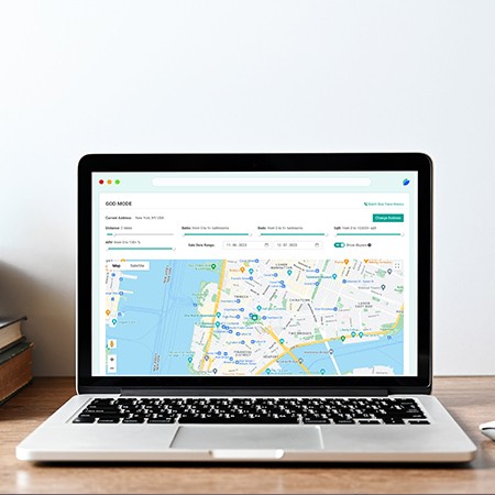
As location-based data becomes central to business intelligence, marketing, logistics, and safety, technologies like reverse geocoding have emerged as essential tools. But what exactly is reverse geocoding, and how are businesses across various industries leveraging it to create value?
In this blog, we’ll dive into what reverse geocoding is, explore its diverse applications across various industries
What Is Reverse Geocoding?
Reverse geocoding is the process of converting geographic coordinates (latitude and longitude) into a human-readable address or place name. This is the opposite of geocoding, which takes an address and returns the corresponding geographic coordinates.
For example:
- Input: Latitude: 34.0522, Longitude: -118.2437
- Output: 200 N Spring St, Los Angeles, CA 90012
Reverse geocoding typically returns:
- Street address
- Neighborhood
- City
- County
- State
- ZIP code
- Country
This data becomes actionable for any app, platform, or workflow where you need to contextualize raw location data.
How Does Reverse Geocoding Work?
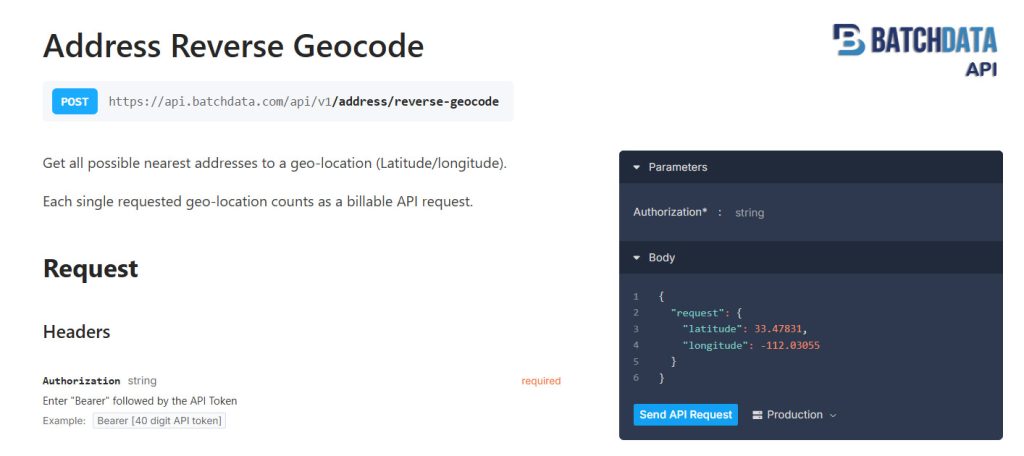
Reverse geocoding leverages geospatial datasets and mapping services to match GPS coordinates to a known address or point of interest. This often involves:
- Accessing a geospatial database (e.g., OpenStreetMap, proprietary datasets).
- Identifying the nearest address or landmark.
- Returning structured data (JSON, XML) with relevant location metadata.
Most modern applications use reverse geocoding via APIs for real-time and batch processing. That’s where solutions like BatchData come in by providing scalable, high-quality geolocation services via API.
Industry-Specific Use Cases for Reverse Geocoding
Reverse geocoding has broad applications across sectors. Below are key use cases by industry:
1. Real Estate and PropTech
- Property Mapping: Convert GPS points to actual street addresses to match them with property records.
- Lead Enrichment: Enhance raw lead data (like a pin drop) with property details, ZIP codes, and neighborhoods.
- Investment Analysis: Group properties by city, neighborhood, or school district using reverse geocoded data.
2. Logistics and Transportation
- Route Optimization: Understand exact pickup and drop-off locations to streamline fleet routes.
- Accident Reporting: Auto-populate addresses when drivers report incidents from mobile apps.
- Geofencing Alerts: Notify when vehicles enter/leave specific zones using address-based logic.
3. Emergency Services and Public Safety
- 911 Call Location Mapping: Translate coordinates from mobile callers into addresses for dispatchers.
- Natural Disaster Response: Tag affected areas based on GPS inputs and create response zones by address.batchdata | Stoplight
4. Retail and E-commerce
- Customer Delivery Validation: Confirm delivery addresses based on customer GPS location during checkout.
- In-Store Analytics: Track foot traffic and convert heatmaps into insights based on actual streets or intersections.
5. Marketing and Advertising
- Geo-targeted Campaigns: Match app user coordinates to ZIP codes or cities for localized messaging.
- Audience Segmentation: Use neighborhood-level data to segment leads and prospects more accurately.
6. Insurance and Risk Assessment
- Claim Location Verification: Confirm accident or damage reports based on GPS-tagged photos or app data.
- Risk Modeling: Assess property or asset risk based on reverse-geocoded location (e.g., flood zones, crime data).
7. Travel and Hospitality
- Itinerary Enrichment: Auto-tag photos or trip logs with location names and addresses.
- Check-in Verification: Confirm real-world locations for hotel or attraction check-ins based on mobile GPS.
8. Mobile App Development
- User Experience: Convert location into readable formats (e.g., “You’re near Central Park”).
- Content Personalization: Show local news, events, or weather based on real-time location input.
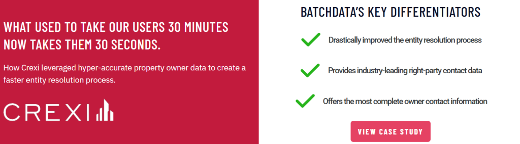
Why Use BatchData for Reverse Geocoding?
If you’re in real estate or looking for a high-performance data API provider, BatchData offers a scalable and accurate reverse geocoding solution with additional capabilities tailored to real estate and business workflows.
What Makes BatchData Different?
- Real Estate-Centric: Unlike general-purpose APIs, BatchData focuses on real estate context, providing enriched data like equity, ownership, property type, and more.
- High Volume, Low Latency: Built for enterprise-scale throughput with minimal response times.
- Secure and Developer-Friendly: RESTful API with secure token access, JSON response, and robust documentation.
- Multi-Functionality: Beyond reverse geocoding, BatchData also supports:
- Skip tracing
- Property ownership data
- Vacancy checks
- High equity filters
- Mailing address standardization
Real-World Example:
A wholesaler captures GPS coordinates from field agents and uses BatchData to:
- Reverse geocode the coordinates to a property address.
- Instantly check for ownership, mortgage balance, and equity.
- Add the lead into a marketing sequence—all automated via API.
Visit BatchData to learn more or start your API integration today.
Choosing the Right Reverse Geocoding API
When selecting a reverse geocoding API, consider the following:
- Accuracy: Are results tied to verified address data?
- Speed / Latency : Is it fast enough for real-time applications?
- Support: Can it handle thousands or millions of coordinates at once?
- Pricing: Are you paying for what you use? Flat-rate vs. pay-per-request.
- Contextual Data: Does it return only the address, or more useful metadata
BatchData checks all these boxes, especially for users in real estate and high-volume lead processing.
Final Thoughts
Reverse geocoding is more than just converting lat-long pairs into addresses, it’s a gateway to context, insight, and smarter decision-making. From logistics to real estate to emergency response, its applications are growing fast.
Whether you’re enriching property data, validating leads, or mapping field activity, reverse geocoding APIs like BatchData can help you scale your data strategy with precision and performance.